 Wawa-news.com You can't hear the 'big picture'!
Dec 2, 2021 at 06:30 School Buses All buses are running as scheduled for Wawa and Area. Due to icy road conditions and in the interest of safety, all school-related transportation services are cancelled today for all Boards in the Central Algoma Area (including Echo Bay, Bruce Mines, Desbarats, St. Joe Island, Thessalon). Schools will remain open. (updated at 6:46 a.m.) Highway Closures Hwy ...
Read More »Weather/Roads
Winter weather travel advisory (Pukaskwa Park to Searchmont) – Ended
Dec 2, 2021 at 06:25 – updates added 7:02 PM EST Wednesday 01 December 2021 Weather advisory in effect for: White River – Dubreuilville (ended Dec 2 – 5:24 a.m.) Wawa – Pukaskwa Park (ended Dec 2 – 3:22 a.m.) Agawa – Lake Superior Park (ended Dec 2 – 3:22 a.m.) Searchmont – Montreal River Harbour – Batchawana Bay (ended ...
Read More »Strong Winds expected (Sault Ste. Marie – St. Joseph Island)
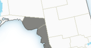
Nov 30, 2021 at 06:36 6:27 AM EST Tuesday 30 November 2021 Special weather statement in effect for: Sault Ste. Marie – St. Joseph Island Strong winds expected late this afternoon. Strong northwesterly winds gusting up to 80 km/h are expected with the passage of a strong cold front late this afternoon. The strong winds are expected to slowly weaken ...
Read More »Area Road Conditions – Nov. 30 at 06:16
Nov 26, 2021 at 05:57 All buses are running as scheduled. updated at: 5:23 a.m. Primary Conditions Secondary Conditions Visibility Hwy 17 West/North 50km From Wawa to Paint Lake Rd, Wawa bare and wet snow covered, snow packed good 70km From Paint Lake Rd, Wawa to Mobert bare and wet good 101 63km From Wawa to Hwy 651 (Missinabi ...
Read More »Winter Weather Travel Advisory (LSPP – Searchmont)
Nov 30, 2021 at 05:41 5:28 AM EST Tuesday 30 November 2021 Weather advisory in effect for: Agawa – Lake Superior Park Searchmont – Montreal River Harbour – Batchawana Bay Winter weather travel advisory in effect for today. Lake enhanced snowfall is expected to begin this morning and continue through the day. Total snowfall amounts of 5 to 10 cm ...
Read More »Area Road Conditions – Nov. 26 at 05:57
Nov 26, 2021 at 05:57 All buses are running as scheduled. updated at: 5:16 a.m. Primary Conditions Secondary Conditions Visibility Hwy 17 West/North 50km From Wawa to Paint Lake Rd, Wawa partly snow packed good 70km From Paint Lake Rd, Wawa to Mobert bare and dry partly snow covered good 101 63km From Wawa to Hwy 651 (Missinabi Corners) partly ...
Read More »Freezing Drizzle Advisory
Nov 25, 2021 at 10:07 At 9:50 Environment Canada stated that widespread freezing drizzle was no longer expected. Nov 25, 2021 at 07:07 At 5:26 this morning, Environment Canada (EC)issued a Freezing Drizzle Advisory for the following regions: White River – Dubreuilville Manitouwadge – Hornepayne EC warns that areas of freezing drizzle are expected or occurring.” Early this morning that ...
Read More »Area Road Conditions – Nov. 25 at 06:19
Nov 25, 2021 at 06:10 All buses are running as scheduled. updated at: 5:23 a.m. Primary Conditions Secondary Conditions Visibility Hwy 17 West/North 50km From Wawa to Paint Lake Rd, Wawa bare and wet good 70km From Paint Lake Rd, Wawa to Mobert bare and dry bare and wet good 101 63km From Wawa to Hwy 651 (Missinabi Corners) bare ...
Read More »Area Road Conditions – Nov. 24 at 06:45
Nov 24, 2021 at 06:45 All buses are running as scheduled. updated at: 5:23 a.m. Primary Conditions Secondary Conditions Visibility Hwy 17 West/North 50km From Wawa to Paint Lake Rd, Wawa bare and dry bare and wet good 70km From Paint Lake Rd, Wawa to Mobert bare and dry good 101 63km From Wawa to Hwy 651 (Missinabi Corners) bare ...
Read More »Hwy 17 (Batchawana to Wawa) OPEN
Nov 22, 2021 at 20:14 Hwy 17 has been reopened. Snow squalls are expected to continue overnight (Montreal River Harbour – St. Joseph Island) – drive safely and be aware of changing road conditions. Nov 22, 2021 at 17:13 Hwy 17 closed from Wawa to Batchawana Bay due to weather conditions according to ON511. OPP tweet that the highway in ...
Read More »Weather Warnings (Sault Ste. Marie – Superior East)
Nov 22, 2021 at 05:40 5:36 AM EST Monday 22 November 2021 Snow squall warning in effect for: Sault Ste. Marie – St. Joseph Island Searchmont – Montreal River Harbour – Batchawana Bay Persons in or near this area should be on the lookout for adverse weather conditions and take necessary safety precautions. Watch for updated statements. Nov 22, ...
Read More »Weather Warnings (Chapleau – Gogama)
Nov 22, 2021 at 05:16 5:01 AM EST Monday 22 November 2021 Weather advisory ended for: Gogama – Foleyet 5:00 AM EST Monday 22 November 2021 Weather advisory ended for: Chapleau – Missinaibi Lake Nov 21, 2021 at 23:15 10:27 PM EST Sunday 21 November 2021 Weather advisory in effect for: Chapleau – Missinaibi Lake Winter weather travel advisory in ...
Read More »Weather Warnings (Wawa – White River – Pukaskwa)
Nov 22, 2021 at 05:14 05:13 EST Monday 22 November 2021 No Alerts in effect. Nov 21, 2021 at 21:45 9:32 PM EST Sunday 21 November 2021 Weather advisory in effect for: Wawa – Pukaskwa Park White River – Dubreuilville Winter weather travel advisory in effect for tonight. A sharp cold front is moving east through the region, and has ...
Read More »Weather Warnings (Geraldton – Manitouwadge – Hornepayne)
Nov 22, 2021 at 05:13 05:11 EST Monday 22 November 2021 No Alerts in effect. Nov 21, 2021 at 21:45 9:32 PM EST Sunday 21 November 2021 Weather advisory in effect for: Manitouwadge – Hornepayne Winter weather travel advisory in effect for tonight. A sharp cold front is moving east through the region, and has a burst of heavy snow ...
Read More »Area Road Conditions – Nov. 20 at 07:27
Nov 20, 2021 at 07:27 Hwy 17 is reduced to one lane in the Mom/Dad/Baby Lake – Trapper’s Trail due to environmental clean up. updated at: 5:22 a.m. Primary Conditions Secondary Conditions Visibility Hwy 17 West/North 50km From Wawa to Paint Lake Rd, Wawa bare and dry good 70km From Paint Lake Rd, Wawa to Mobert bare and wet good ...
Read More »