Wawa-news.com Local and Regional News
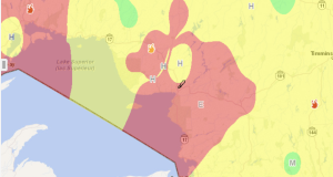
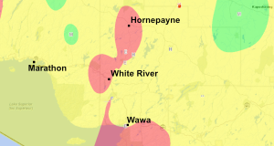
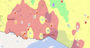
12:32: A number of active wildfires throughout the region have resulted in evacuation orders and alerts for several communities. Residents from Armstrong, Whitesand First Nation, and Collins First Nation are currently seeking shelter in Thunder Bay. In addition, residents of Upsala, Lac des Mille Lacs First Nation, and the surrounding area are currently evacuating, while those in the area of ...
Read More »City of Thunder Bay – Wildfire Update