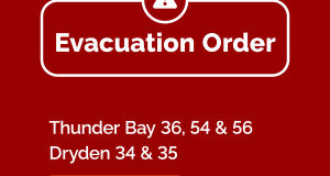
Wawa-news.com Local and Regional News
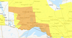
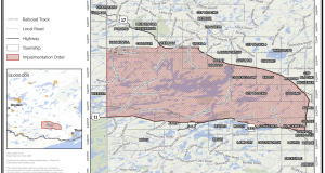
3:05 AM EDT Monday 20 July 2026 Impact Level: Moderate Forecast Confidence: High Smoke is causing or expected to cause poor air quality and reduced visibility in regions in yellow (shown at right). Localized poor air quality and reduced visibility due to wildfires smoke is expected to continue today. Conditions are expected to improve this afternoon. Environment Canada continues the ...
Read More »Air Quality – Yellow Alert (July 20)