 Wawa-news.com Local and Regional News
Severe thunderstorm warning in effect for: White River – Dubreuilville
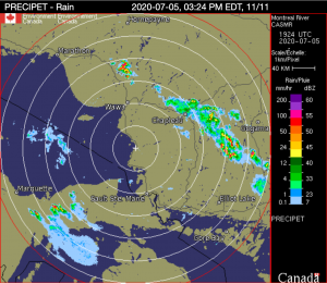 At 2:41 p.m. EDT, Environment Canada meteorologists are tracking a severe thunderstorm capable of producing very strong wind gusts, up to nickel size hail and heavy rain. This line of severe thunderstorms is located from Woman River Forest Provincial Park to 6 kilometres south of Dog Lake, moving southeast at 40 km/h.
Locations impacted include: Woman River Forest Provincial Park, Como Lake, Borden Lake, Kinogama, Kormak and Sultan.
Heavy downpours can cause flash floods and water pooling on roads. Large hail can damage property and cause injury. Strong wind gusts can toss loose objects, damage weak buildings, break branches off trees and overturn large vehicles. Lightning kills and injures Canadians every year. Remember, when thunder roars, go indoors!
Severe thunderstorm warnings are issued when imminent or occurring thunderstorms are likely to produce or are producing one or more of the following: large hail, damaging winds, torrential rainfall.
The Office of the Fire Marshal and Emergency Management recommends that you take cover immediately if threatening weather approaches.
Please continue to monitor alerts and forecasts issued by Environment Canada. To report severe weather, send an email to [email protected] or tweet reports using #ONStorm.
For more information: http://www.emergencymanagementontario.ca/english/beprepared/beprepared.html.
12:49 PM EDT Sunday 05 July 2020
Heat Warning in effect for:
- White River – Dubreuilville
- Wawa – Pukaskwa Park
Persons in or near this area should be on the lookout for adverse weather conditions and take necessary safety precautions. Watch for updated statements.
Please refer to the latest public forecasts for further details and continue to monitor the situation through your local radio and television stations or Weatheradio.
Severe thunderstorm watch in effect for:
- White River – Dubreuilville
Conditions are favourable for the development of severe thunderstorms that may be capable of producing strong wind gusts and large hail.
Hazards:
– Damaging wind gusts to 90 km/h
– Nickel sized hail
Locations:
Portions of northeastern and central Ontario including Chapleau, Sudbury, North Bay, Algonquin Park and Burk’s Falls.
Timing:
This afternoon and early evening.
Large hail can damage property and cause injury. Strong wind gusts can toss loose objects, damage weak buildings, break branches off trees and overturn large vehicles. Lightning kills and injures Canadians every year. Remember, when thunder roars, go indoors!
Severe thunderstorm watches are issued when atmospheric conditions are favourable for the development of thunderstorms that could produce one or more of the following: large hail, damaging winds, torrential rainfall.
The Office of the Fire Marshal and Emergency Management recommends that you take cover immediately if threatening weather approaches.
Please continue to monitor alerts and forecasts issued by Environment Canada. To report severe weather, send an email to [email protected] or tweet reports using #ONStorm.

- KZA Evacuation Update (July 21 at 7 a.m. - July 21, 2026
- First Nation Leaders to Hold Press Conference to Address Ontario’s Wildfire Response - July 21, 2026
- Northwestern Ontario Community Support Fund Established - July 21, 2026