Weather, Closures, Forest Fires

Northeast Forest Fire Update – June 11

As of the early evening of June 11, there are three active wildland fires in the region. Chapleau 4 is located north of Hwy 101 between Timmins and Chapleau. It is being held at 16.5 hectares. Sudbury 2 is under control at 0.2 of a hectare, on the southwest side of Windy Lake. Timmins 2 was remapped at 5622 hectares on ...

Read More »

Sultan Road remains Closed due to Culvert Washout

      Wawa-news reported yesterday afternoon at 4:30 that reports were that the Sultan Road was impassable due to a culvert that had washed out in the rain. That was confirmed by EACOM Timber Corporation that at KM 69 the road has washed away. This morning EACOM Timber Corporation advises that their staff are on their way to assess ...

Read More »

Northeast Forest Fire Update- June 11

As of the early evening of June 10, there are four active wildland fires in the region. Chapleau 4 is located north of Hwy 101 between Timmins and Chapleau. It is being held at 16.5 hectares. Sudbury 2 is under control at 0.2 of a hectare, on the southwest side of Windy Lake. Sudbury 6 is under control at 0.5 of ...

Read More »

Rainfall Warning continues Southeast of Wawa

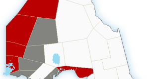
A Rainfall Warning is in effect for: •    Agawa – Lake Superior Park •    Montreal River Harbour – Batchawana Bay – Searchmont •    Sault Ste. Marie – St. Joseph Island •    Blind River – Thessalon •    Chapleau – Missinaibi Lake Rain, at times heavy, continues. Heavy rainfall will continue today and into tonight. Total rainfall amounts near 50 ...

Read More »

Mattagami First Nation Declares State of Emergency

Mattagami First Nation Emergency Management has declared a State of Emergency as of 5:30 p.m. Sunday Evening, June 9th, 2019 for Preventative Precautionary Measures to ensure all Community Members are safe. TIM002 Fire is approximately 2,500 hectares. Smoke is visible and power interruption is possible. People on the evacuation list at this time will be people with illness; the elderly, parents ...

Read More »

TIM002 UPDATE – June 9

Timmins Forest Fire 2 (referred to as TIM002) was confirmed on June 6, 2019. This evening, June 9, 2019, the Ministry of Natural Resources and Forestry (MNRF) estimated TIM002 to be 6,000 hectares. The fire is approximately 4 kilometres west of the community of Gogama, and burning on the west side of Highway 144, running parallel to the roadway. It’s ...

Read More »

Northeast Forest Fire Update – June 9

By the time this report was created there were two new fires in the Northeast Region. Sudbury 6 is located on the south shore of the French River, approximately eight kilometres southeast of Ouellette. The 0.2 hectare fire is not under control. Parry Sound 3 is located approximately 11 kilometres northeast of Britt. The fire is out at 0.1 hectares. ...

Read More »

Rainfall Warning

2:46 PM EDT Sunday 09 June 2019 Rainfall warning in effect for: Agawa – Lake Superior Park Sault Ste. Marie – St. Joseph Island Searchmont – Montreal River Harbour – Batchawana Bay Persons in or near this area should be on the lookout for adverse weather conditions and take necessary safety precautions. Watch for updated statements. Please refer to the ...

Read More »

Northeast Forest Fire Update – June 6

As of the afternoon of June 6, there are three active wildland fires in the region. Sudbury 2 measures 0.2 of a hectare and is under control. It is located on the southwest side of Windy Lake. Kirkland Lake 1 measures 1.5 hectare and is located southwest of Vigrass Lake, approximately 3 km southwest of the community of Swastika. Wawa ...

Read More »

Northeast Forest Fire Update – June 5

As of the afternoon of June 5, there are two active wildland fires in the region. Chapleau 3 is being held at 0.8 of a hectare, approximately 30 km northwest of Chapleau, outside the northeast boundary of The Shoals Provincial Park. Sudbury 2 measures 0.2 of a hectare and is under control. It is located on the southwest side of Windy Lake. At ...

Read More »

Private Member’s Bill to Improve winter driving along Hwy 11 & 17 Corridors

NDP MPP Guy Bourgouin held a press conference at Queen’s Park on Wednesday to introduce a Private Member’s Bill that will improve maintenance standards and make winter driving safer on northern Ontario’s main Highways 11 and 17. Bourgouin, MPP for Mushkegowuk-James Bay, was joined by representatives from northern communities and businesses who said improving winter road maintenance in Northern Ontario is urgently needed. “Too ...

Read More »

Northeast Forest Fire Update – June 4

As of the afternoon of June 4, there is one active wildland fire in the region. Sudbury 2 measures 0.2 of a hectare and is under control at the time of this update. It is located on the southwest side of Windy Lake. At the time of this update, the fire hazard is mostly low to moderate across the region ...

Read More »

Thunder Bay OPP warn of Closed Roads due to flooding

Officers from the Thunder Bay Detachment of the Ontario Provincial Police (OPP), members of the Nolalu Emergency Services, Ministry of Transportation (MTO), Ministry of Natural Resources and Forestry (MNRF) along with support service from the Lakehead Region Conservation Authority (LRCA), are currently in the Unincorporated Township of Nolalu.   Currently, there are several road closures at the following locations: Highway ...

Read More »

Fatal Collision Closes Hwy 17 west of Nairn Centre

On Monday, June 3, 2019, at approximately 1:39 p.m., members from the Manitoulin Detachment of the Ontario Provincial Police (OPP), the Sudbury-Manitoulin Emergency Medical Services (EMS), the Nairn-Hyman Fire Department, the Baldwin Fire Department and the Lively Fire Department, responded to a motor vehicle collision involving two vehicles on Highway 17 in Nairn Township, Ontario, approximately 10 kilometers west of ...

Read More »

Northeast Forest Fire Update – June 3

As of the afternoon of June 3, there are two active wildland fires in the region. Chapleau 2 measures 0.4 of a hectare and is under control. It is located west of Spanish River Provincial Park, more specifically west of Low Lake. Sudbury 2 measures 0.3 of a hectare and is not yet under control at the time of this update. It ...

Read More »