 Wawa-news.com Local and Regional News
There were no new fires in the Northeast Region by late afternoon on June 14. At the time of this update, there is one wildland fire in the region.
Timmins 2 remains at 5622 hectares, and its status is “not under control”. The fire remains approximately 4 kilometres west of the community of Gogama. The fire is burning on the west side of Highway 144 and running parallel to the roadway.
Past rain is allowing crews to make good progress establishing hose lines.
Ministry of Natural Resources and Forestry staff continue to work with the community of Gogama to aid community leaders and area residents.
At the time of this update, the fire hazard is low to moderate across the Northeast region; with the exception of an area north of Wawa that is showing a high hazard.
UPDATE TO TRAVEL RESTRICTIONS IN PARTS OF TIMMINS DISTRICT DUE TO FOREST FIRE IMPOSED BY MNRF TIMMINS DISTRICT
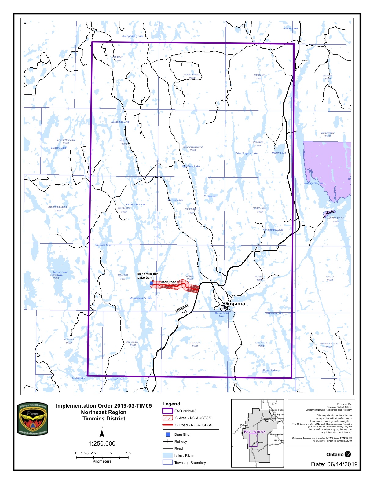 Pursuant to the Emergency Area Order signed June 11, 2019, an Implementation Order has been issued by the Ministry of Natural Resources and Forestry prohibiting access and travel in portions of Timmins District where there are public safety hazards as a result of fire activity from Timmins #002.
The Order restricts travel, access and use in an identified area and may be modified regularly to reflect changing fire conditions.
This measure has been put in place to ensure public safety while allowing fire personnel to safely and effectively suppress the fires in the identified area.
All travel and use of Jack Road from the intersection of Jack Road and Highway 144, westerly to the Ontario Power Generation Mesomekenda Lake Dam, at Mesomekenda Lake is prohibited.
All use and occupation of Crown Land or within 500 metres of the described closed roads within this area is prohibited.
If a member of the public believes that access within the restricted travel area is necessary for non-recreational purposes, please call 705-235-1334 to request a travel authorization permit. MNRF will review the request for access based on the rationale provided, local fire activity, and the potential fire risk.
Please visit ontario.ca/forestfire to view the current access restrictions and fire activity as this site is being updated regularly.
See the restricted travel and access areas on the PDF map attached (Note: this map gets updated regularly).
More Information
For updates on highway closures, check Ontario511 or @OPPCommunicationsNER on Twitter, and Ontario Provincial Police-Northeast Region on Facebook.
For information about the current forest fire situation: 1-888-220-7242. For updates on the fire situation, visit ontario.ca/forestfire or follow us on Twitter @ONforestfires.
To report a forest fire located north of the French and Mattawa rivers, please dial 310-FIRE
- Northeast Forest Fire Region Update – November 1 - November 1, 2025
- Northeast Forest Fire Region Update – October 31 - October 31, 2025
- Northeast Forest Fire Region Update – October 30 - October 30, 2025
