 Wawa-news.com Local and Regional News
 There was 1 new wildland fire confirmed in the Northeast Region today:
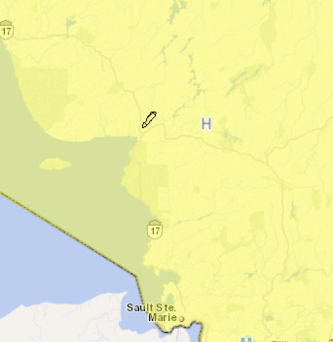
- Cochrane 5 (COC005) is 2.8 hectares and is located approximately 6 kilometres west of Hearst, next to Highway 11. The fire is not under control.
There are 3 active wildland fires in the Northeast Region; 1 is under control, and 2 are not under control.
The fire hazard varies from low to high across the Northeast Region.
Map from https://cwfis.cfs.nrcan.gc.ca/interactive-map
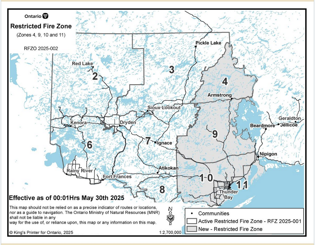 In the northwest region of the province, due to high to extreme forest fire hazard conditions, the MNR has implemented another Restricted Fire Zone in the Northwest Region. Zones 2, 3, 4, 6, 7, 8, 9, 10 and 11 are now under an RFZ (see map at right).
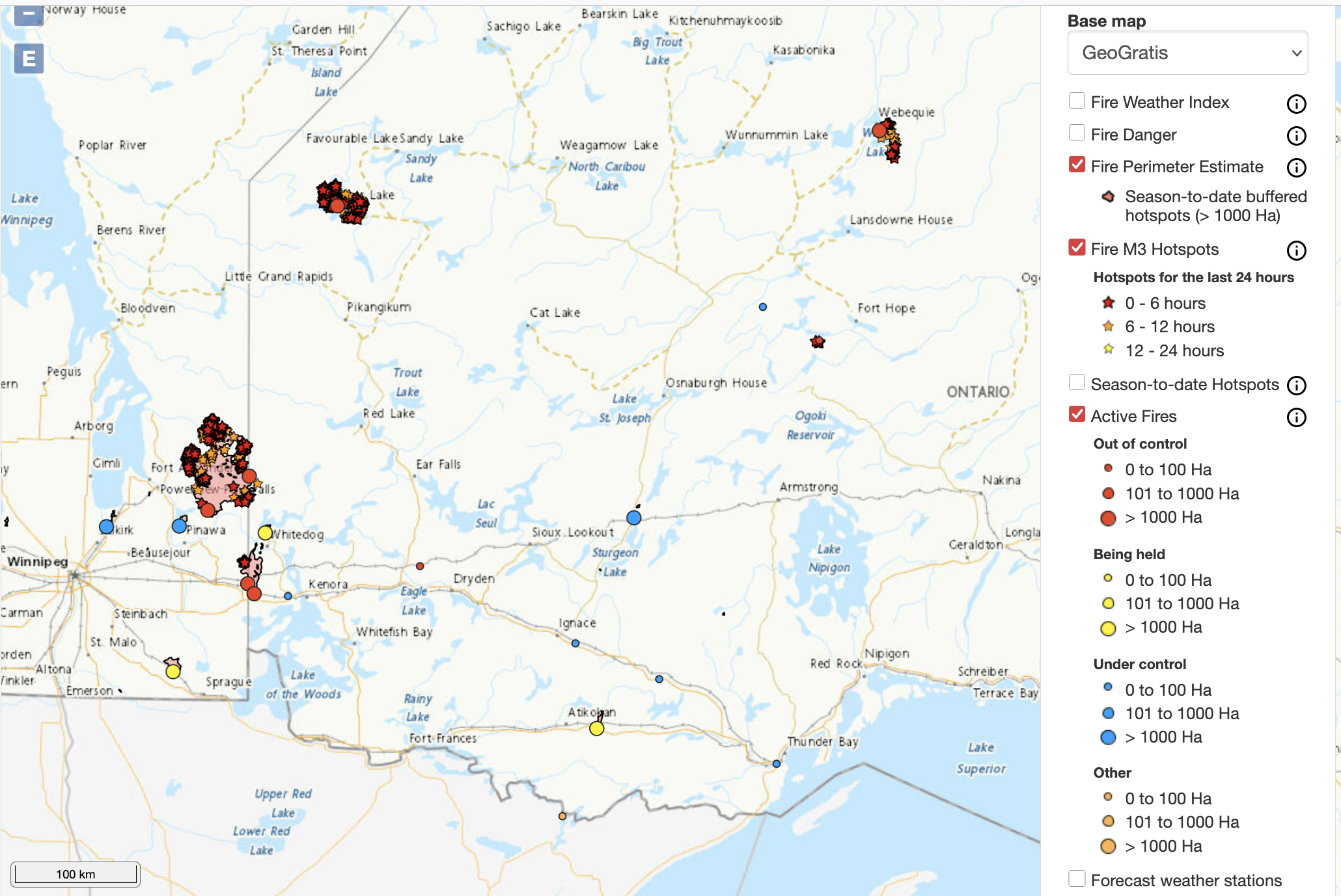
There are 12 active fires in the Northwest Region in various stages of control. The fire hazard is high to extreme across the majority of the Northwest Region.
Fires of note:
- Red Lake 12 – Deer Lake First Nation at 17,988 hectares, Deer Lake First Nation has declared a full evacuation due to the Red Lake 12 fire
- Nipigon 5 – Webequie First Nation at 7,506.9 hectares, not under control, evacuation is beginning for Webequie First Nation residents
- Kenora 20 – Ingolf, Wabaseemoong at 35,151.7 hectares, not under control
- Kenora 14 (KEN 014) – currently being held at 1,607 hectares, being held
- Fort Frances 4 (FOR 004) – currently being held at 3,593 hectares, being held
- Kenora 32 (Woodland Caribou Provincial Park) – at 7,716 hectares, not under control, evacuation order in place.
The Ministry of Natural Resources and Forestry (MNRF) is a government ministry of the Canadian province of Ontario that is responsible for Ontario’s provincial parks, forests, fisheries, wildlife, mineral aggregates and the Crown lands and waters that make up 87 per cent of the province. Its offices are divided into Northwestern, Northeastern and Southern Ontario regions with the main headquarters in Peterborough, Ontario.[1]
Latest posts by Natural Resources Forestry (see all)
- Northeast Forest Fire Region Update – November 1 - November 1, 2025
- Northeast Forest Fire Region Update – October 31 - October 31, 2025
- Northeast Forest Fire Region Update – October 30 - October 30, 2025
