Wawa-news.com Local and Regional News
Apr 13, 2020 at 15:45
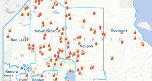
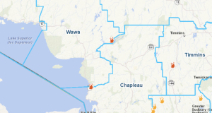
Highway 631 CLOSED from White River to Hwy 11 Junction, Highway 11 from Kapuskasing to Longlac.
Winter storm warning in effect for:
- Wawa – Pukaskwa Park
- White River – Dubreuilville
Major winter storm continues today.
Heavy snow will continue today as a strong low pressure system tracks across Northeastern Ontario. Northerly winds gusting up to 60 km/h in some areas will also cause widespread blowing snow. This snow and blowing snow will taper to flurries tonight.
Total snowfall amounts in the 30 to 50 cm range are expected by the time the snow comes to an end.
Consider postponing non-essential travel until conditions improve. Surfaces such as highways, roads, walkways and parking lots may become difficult to navigate due to accumulating snow. Road closures are possible.
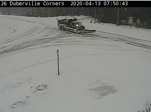
Dubreuilville Corners MTO WeatherCam
5:13 AM EDT Monday 13 April 2020
Winter storm warning in effect for:
- Wawa – Pukaskwa Park
- White River – Dubreuilville
Major winter storm continues today.
Heavy snow will continue today as a strong low pressure system tracks across Northeastern Ontario. Northerly winds gusting up to 60 km/h will also cause widespread blowing snow. This snow and blowing snow will taper to flurries tonight.
Total snowfall amounts in the 30 to 50 cm range are expected by the time the snow comes to an end.
Consider postponing non-essential travel until conditions improve. Surfaces such as highways, roads, walkways and parking lots may become difficult to navigate due to accumulating snow. Road closures are possible.
5:15 AM EDT Monday 13 April 2020
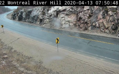
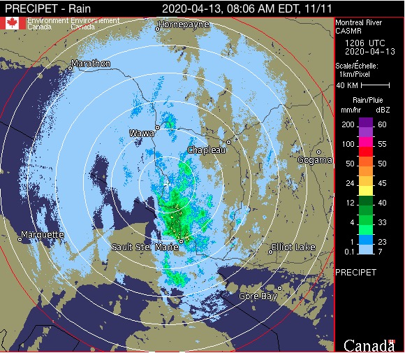
Montreal River MTO WeatherCam
Winter storm warning in effect for:
- Agawa – Lake Superior Park
Heavy snow across many areas today. Mainly rain with the risk of freezing rain for other areas.
Snow and rain will continue over the area today. A narrow zone of freezing rain has also developed near a frontal boundary. This boundary extends from near Timmins to near Chapleau to Lake Superior Park this morning but will continue to drift northward today. By this evening any freezing rain associated with this boundary will come to an end or transition back to snow. The snow will taper to flurries tonight. Strong northwesterly winds gusting up to 50 km are also forecast to develop later today resulting in local blowing snow.
Significant snowfall amounts in the 25 to 40 cm range are expected by the time the snow comes to and end.
Consider postponing non-essential travel until conditions improve. Surfaces such as highways, roads, walkways and parking lots may become difficult to navigate due to accumulating snow. Road closures are possible.
4:38 AM EDT Monday 13 April 2020
Special weather statement in effect for:
- Sault Ste. Marie – St. Joseph Island
- Searchmont – Montreal River Harbour – Batchawana Bay
Rain coming to an end and strong winds developing this afternoon.
Moderate to heavy rain this morning will transition to flurries this afternoon. Total rainfall amounts of 15 to 25 mm are now expected.
Strong westerly winds are also forecast to develop this afternoon. Wind gusts up to 70 or 80 km/h will be possible, particularly in areas along the shorelines of Lake Superior and Lake Huron. These winds will ease tonight.
Some power outages will be possible due to the strong, gusty winds.

- Saturday Morning News – March 9 - March 9, 2024
- Hwy 101 (Wawa to Chapleau) OPEN - June 17, 2023
- Hwy 631 (White River to Hwy 11) OPEN - January 17, 2023