 Wawa-news.com Local and Regional News
There were 2 new fires discovered today by late afternoon.
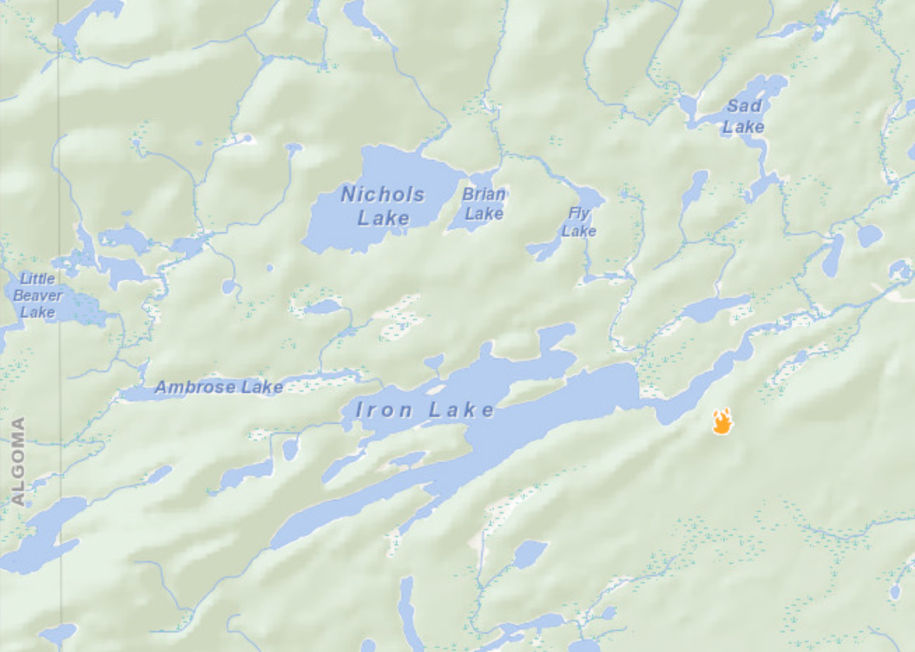
WA004 is just east of Iron Lake.
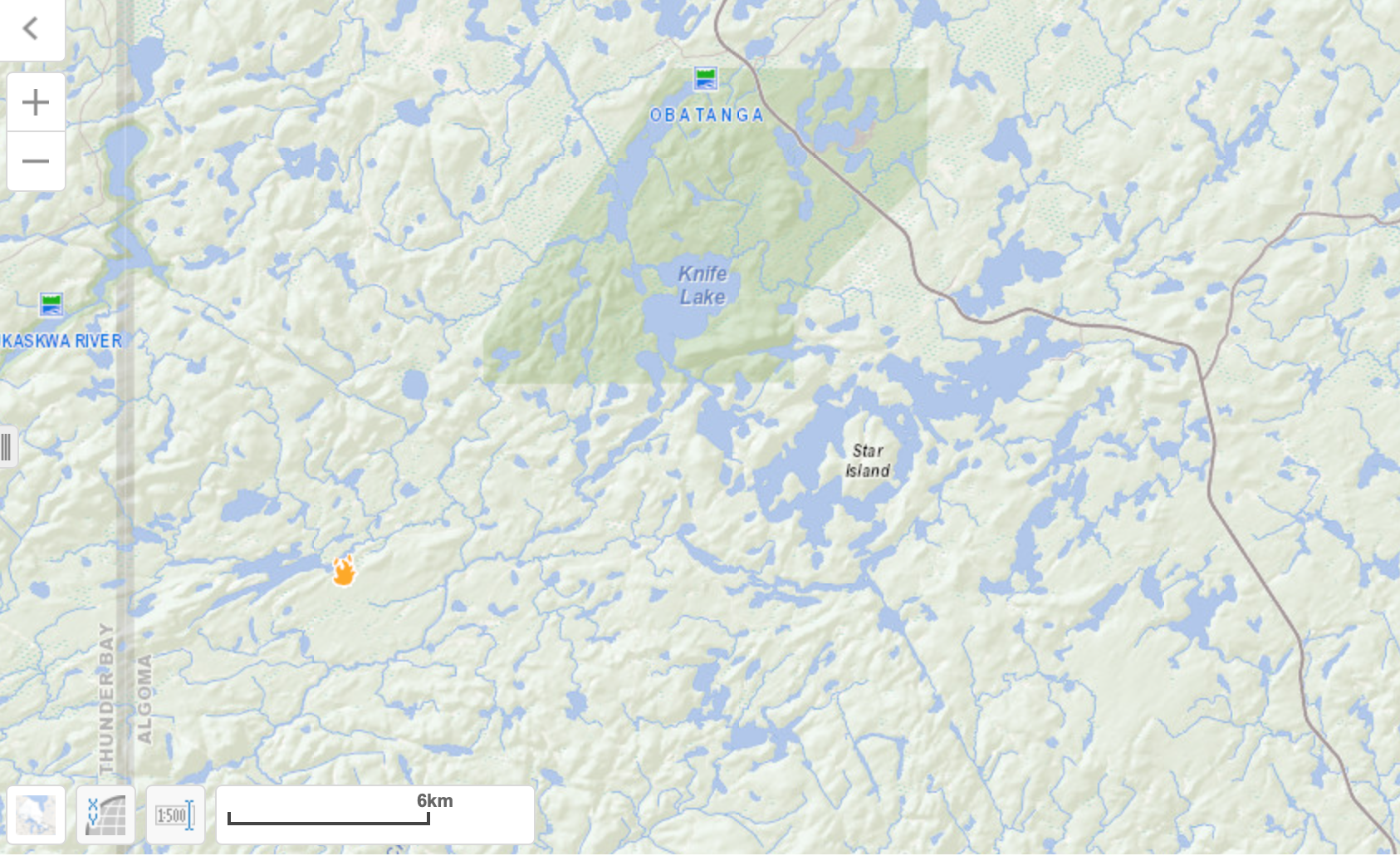
 Wawa 4 is not under control at 0.1 of a hectare and is located southwest of Obatanga Provincial Park. Pembroke 1 is not under control at 0.1 of a hectare. This fire is located north of Highway 58. At the time of this update, there are three other active wildland fires in the region. North Bay 4 is being observed at 0.1 of a hectare. The fire is located on an island on Denedus Lake. Cochrane 10 measures 74 hectares and is being observed, approximately 100km southeast of Moose Factory. Timmins 2 is under control at 4,645 hectares.
The forest fire hazard ranges from low to extreme, with the areas of most concern situated in the central and western portions of the region. For up to date forest fire hazard conditions in your area, see the interactive fire map at Ontario.ca/forestfires.
Help fight forest fires – stay clear of waterbombers
When waterbombers approach a body of water, move close to the shore so they can perform their scoop. A waterbomber will not scoop from a lake or river if encroaching watercraft pose a safety hazard.
More Information
For updates on highway closures, check Ontario511 or @OPPCommunicationsNER on Twitter, and Ontario Provincial Police-Northeast Region on Facebook.
For information about the current forest fire situation: 1-888-220-7242
For updates on the fire situation, visit ontario.ca/forestfire or follow us on Twitter @ONforestfires.
To report a forest fire located north of the French and Mattawa rivers, please dial 310-FIRE. To report a forest fire south of these rivers, dial 911.

- Friday Morning News – July 31st - July 31, 2026
- Thursday Morning News – July 30th - July 30, 2026
- Power Outage in White River, Mobert and Hemlo – RESTORED - July 29, 2026
