 Wawa-news.com Local and Regional News
Dec 27, 2018 @ 12:42
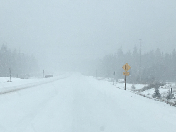
Weather and roads are beginning to show the storm. There is a transport in the ditch 20 kms east of Wawa, and a lane is blocked. Tow trucks are on the scene. This photo was taken just north of Wawa on Highway 17 at 12:30 p.m.
If you are planning to head out today, please be prepared and drive according to weather conditions. Monitor your favourite source for weather and road conditions.
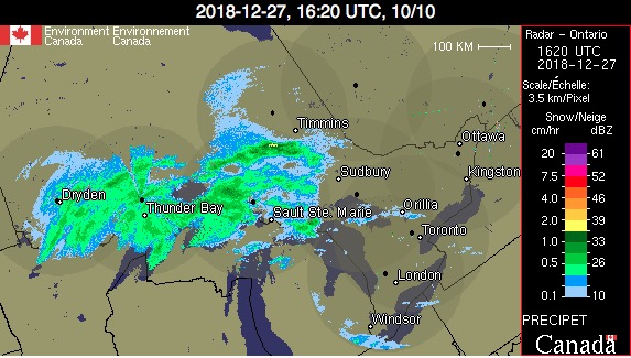
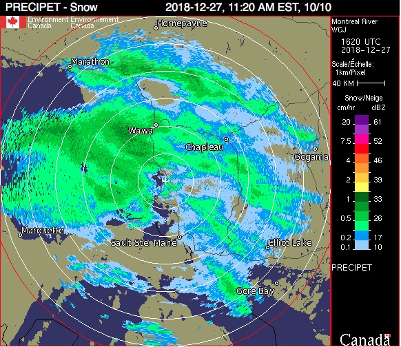
Dec 27, 2018 @ 11:33
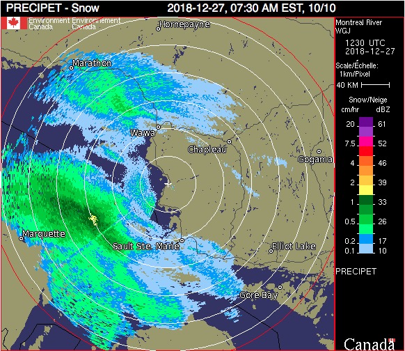
Dec 27, 2018 @ 07:43
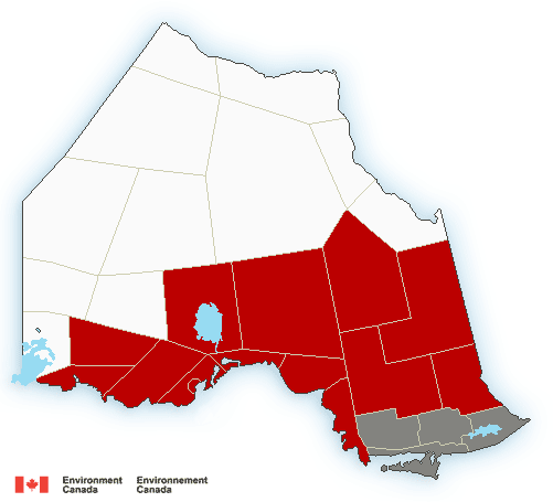 5:07 AM EST Thursday 27 December 2018
Winter storm warning in effect for:
-
- Atikokan – Shebandowan – Quetico Park
- Cloud Bay – Dorion
- Kakabeka Falls – Whitefish Lake – Arrow Lake
- Upsala – Raith
- Chapleau – Missinaibi Lake
- City of Thunder Bay
- Nakina – Aroland – Pagwa
- Beardmore – Jellicoe – Macdiarmid
- Gull Bay – Black Sturgeon Lake
- Marathon – Schreiber
- Nipigon – Rossport
- Agawa – Lake Superior Park
- Sault Ste. Marie – St. Joseph Island
- Searchmont – Montreal River Harbour – Batchawana Bay
- Wawa – Pukaskwa Park
- White River – Dubreuilville
Major winter storm to affect the region today into Friday.
Snow at times heavy is expected to move into the region this morning and persist into Friday. Total snowfall accumulations of 15 to 30 cm are possible. Strong northeast winds gusting to 50 km/h will develop overnight giving locally reduced visibility due to blowing snow.
Conditions should improve Friday afternoon for regions north of Lake Superior and in the evening for regions farther east.
Consider postponing non-essential travel until conditions improve.
Winter storm warnings are issued when multiple types of severe winter weather are expected to occur together.
5:16 AM EST Thursday 27 December 2018
Special weather statement in effect for:
- Sault Ste. Marie – St. Joseph Island
- Searchmont – Montreal River Harbour – Batchawana Bay
- North Bay – Powassan – Mattawa
- West Nipissing – French River
- Blind River – Thessalon
- Espanola – Killarney
- New Liskeard – Temagami
- Greater Sudbury and vicinity
- Elliot Lake – Ranger Lake
Significant winter storm expected this afternoon into Friday night.
A Colorado low that is tracking towards Ontario will bring a mixed bag of weather to Northeastern Ontario this afternoon into Friday. Regions from Sault Ste. Marie to North Bay may see 5 to 10 centimetres of snow and ice pellet accumulation before precipitation changes to rain overnight. In these regions, there is also a threat of a few hours of freezing rain Thursday afternoon or evening. A freezing rain warning may be required. Precipitation should change back to snow Friday as much colder air moves in.
Travel may become hazardous from this afternoon into early Saturday morning.

- Legion to sell Famous Jumbo Wings to Celebrate 80 Years in Wawa Tonight - July 17, 2026
- Friday Morning News – July 17 - July 17, 2026
- Evacuation Order – Fort Frances 14 - July 17, 2026