Wawa-news.com Local and Regional News
Dec 27, 2017 @ 09:10
Across Northern Ontario, the ‘Extreme Cold Warnings’ continue:
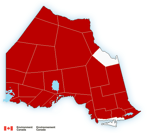 5:23 AM EST Wednesday 27 December 2017
Extreme Cold Warning in effect for:
- Wawa – Pukaskwa Park
- White River – Dubreuilville
A period of very cold wind chills continues.
Extreme wind chill values of minus 40 or below continue this morning.
Wind chills will moderate during the daytime hours, however wind chill values near minus 40 are expected again tonight.
Extreme cold puts everyone at risk.
Watch for cold related symptoms: shortness of breath, chest pain, muscle pain and weakness, numbness and colour change in fingers and toes.
Dress warmly. Dress in layers that you can remove if you get too warm. The outer layer should be wind resistant.
Extreme cold warnings are issued when very cold temperatures or wind chill creates an elevated risk to health such as frost bite and hypothermia.
Dec 26, 2017 @ 17:06
 Across Northern Ontario, the ‘Extreme Cold Warnings’ continue:
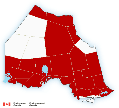
3:36 PM EST Tuesday 26 December 2017
Extreme Cold Warning in effect for:
- Wawa – Pukaskwa Park
- White River – Dubreuilville
A period of very cold wind chills continues.
Extreme wind chill values of minus 40 or below are expected over the next few nights. However, wind chills will moderate during the daytime hours.
Extreme cold puts everyone at risk.
Watch for cold-related symptoms: shortness of breath, chest pain, muscle pain and weakness, numbness and colour change in fingers and toes.
Dress warmly. Dress in layers that you can remove if you get too warm. The outer layer should be wind resistant.
Extreme cold warnings are issued when very cold temperatures or wind chill creates an elevated risk to health such as frost bite and hypothermia.
5:16 AM EST Tuesday 26 December 2017
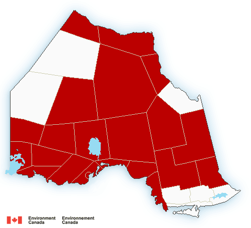 Extreme Cold Warning in effect for:
- Agawa – Lake Superior Park
- Searchmont – Montreal River Harbour – Batchawana Bay
- Wawa – Pukaskwa Park
- White River – Dubreuilville, and many other locations
A period of very cold wind chills continues.
Wind chill values of minus 40 to minus 43 are occurring early this morning. Extreme wind chill values are expected again over the next few nights. However, wind chills will moderate during the daytime hours.
Extreme cold puts everyone at risk.
Watch for cold related symptoms: shortness of breath, chest pain, muscle pain and weakness, numbness and colour change in fingers and toes.
Dress warmly. Dress in layers that you can remove if you get too warm. The outer layer should be wind resistant.
Extreme cold warnings are issued when very cold temperatures or wind chill creates an elevated risk to health such as frost bite and hypothermia.

- Thursday Morning New – July 23rd - July 23, 2026
- Between the Covers – July 22 - July 22, 2026
- Wednesday Morning News – July 22nd - July 22, 2026