Wawa-news.com Local and Regional News
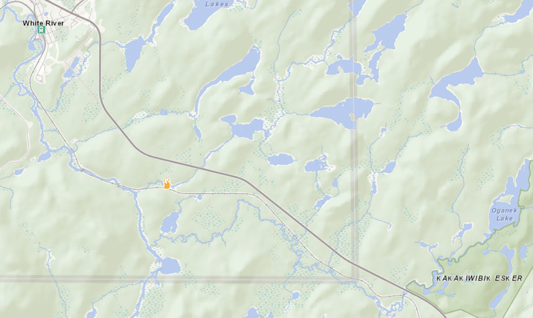
Wawa 10: 4km west of the Depew River Rest Area.
Northeast Region
Updated: July 6, 2026 at 6:00 p.m. Eastern Daylight Time (EDT)
There were 7 new wildland fires were confirmed in the Northeast Region today:
- Wawa 9 (WAW009) is 0.1 of a hectare and is located approximately 0.4 of a kilometre east of Upper Taradale Lake, and 2.2 kilometres northeast of Stillwell Lake. The fire is under control.
- Wawa 10 (WAW010) is 0.1 of a hectare and located approximately 0.5 of a kilometre south of Highway 17, and 0.6 of a kilomtetre north of Mud Lake. The fire is not under control. (location shown above)
- North Bay 17 (NOR017) is 0.1 of a hectare and located on an island on Tee Lake. The fire is under control.
- North Bay 18 (NOR018) is 0.1 of a hectare and located approximately 2 kilometres west of Dorothy Lake, and 3.4 kilometres east of Pinetorch Lake. The fire is not under control.
- North Bay 19 (NOR019) is 0.1 of a hectare and located approximately 2.2 kilometres northeast of Einar Lake, and 3.3 kilometres southwest of Horseshoe Lake. The fire is not under control.
- North Bay 20 (NOR020) is 0.1 of a hectare and located approximately 0.75 of a kilometre east of Little Bull Lake and 0.6 of a kilometre south of Seagram Lake. The fire is not under control.
- North Bay 21 (NOR021) is 0.1 of a hectare and located 1.5 kilometres northeast of Sand Lake and 1.6 kilometres northwest of Third Lake. The fire is not under control.
There are currently 39 active wildland fires in the Northeast Region. Of these: 6 are not under control, 2 are being held, 8 are under control and 23 are being observed.
Northwest Region
Updated: July 6, 2026 at 6:06 p.m. Central Daylight Time (CDT)
Two additional wildland fires were confirmed in the evening of July 5 following the previous update.
- Fort Frances 18 (FOR018) is located in Quetico Provincial Park near Jean Lake. The 0.1-hectare fire is being observed.
- Sioux Lookout 60 (SLK060) is located approximately 33 kilometres west of Pickle Lake, near Bow River. The 0.2-hectare fire is being held.
Two new wildland fires were confirmed in the Northwest Region by the evening of July 6.
- Dryden 22 (DRY022) was located on an island near the south end of Rugby Lake. The 0.1-hectare fire is now out.
- Nipigon 27 (NIP027) is located approximately 8.4 kilometres east of Highway 11, near Hanson Lake. The 2.8-hectare fire is not under control.
At the time of this update there are 74 active wildland fires in the Northwest Region. Of those fires, 14 are not under control, 2 are being held, 10 are under control and 48 are being observed.
Fires of note
Fort Frances 14
- Fort Frances 14 (FOR014) is located approximately 35 kilometres southwest of Upsala near Byers Lake.
- The 1480-hectare fire is not under control
- 14 crews and 8 helicopters are assigned to suppression operations.
- FireRanger crews are focussed on establishing hose lines around the fire perimeter.
Kasabonika Lake First Nation Cluster
- A total of 12 FireRanger crews, 8 fire management personnel, 3 helicopters and 2 fixed wing aircraft are assigned to the Kasabonika Lake First Nation Cluster.
- The wildland fire hazard is high today in the area.
- Nipigon 16 (NIP016) is located approximately 6 kilometers southeast of the Kasabonika Airport. The 1,474.2-hectare wildland fire is not under control.
- Nipigon 12 (NIP012) is located approximately 20 kilometres west of Kasabonika Lake First Nation. The 2,119-hectare wildland fire is not under control.
- There are 3 additional active fires in the area surrounding Kasabonika Lake First Nation.
- Nipigon 13 (NIP013) is not under control at 500.4 hectares.
- Nipigon 14 (NIP014) is not under control at 2.0 hectares
- Nipigon 15 (NIP015) is not under control at 0.1 hectares.
NOTAM at Nipigon 16
There is currently a NOTAM in the area of wildland fire Nipigon 16 near Kasabonika Lake First Nation.
This is over and above the standard airspace restrictions imposed by Section 601.15 of the Canadian Aviation Regulations (CARs) which state that the airspace around all active forest fires is restricted to forest fire suppression aircraft only, specifically airspace within 5 nautical miles, up to an altitude of 3000 feet above ground level.
Pilots are reminded that NOTAMs concerning forest fires can be found on NavCanada’s Collaborative Flight Planning Services under the ‘Weather and NOTAM’ tab, when flight planning.
Sioux Lookout 21 – Wunnumin Lake First Nation
- Sioux Lookout 21 (SLK021) is now measuring 444 hectares and is not under control.
- The fire is approximately 9.0 kilometres south of the Wunnumin Lake First Nation Airport.
- 6 FireRanger crews and 2 helicopters are assigned to suppression operations.
NOTAM at Sioux Lookout 21
There is currently a NOTAM in the area of wildland fire Sioux Lookout 21 near Wunnumin Lake First Nation.
This is over and above the standard airspace restrictions imposed by Section 601.15 of the Canadian Aviation Regulations (CARs) which state that the airspace around all active forest fires is restricted to forest fire suppression aircraft only, specifically airspace within 5 nautical miles, up to an altitude of 3000 feet above ground level.
Pilots are reminded that NOTAMs concerning forest fires can be found on NavCanada’s Collaborative Flight Planning Services under the ‘Weather and NOTAM’ tab, when flight planning.

- FONOM and NOMA Call for Federal-Provincial Partnership to Four- Lane Highways 11 and 17 - September 14, 2026
- NE Forest Fire Region Update – September 14 - September 14, 2026
- NW Forest Fire Region Update – September 13 - September 13, 2026