Wawa-news.com You can't hear the 'big picture'!
Dec 27, 2025 at 06:17
Orange Warning – Winter Storm
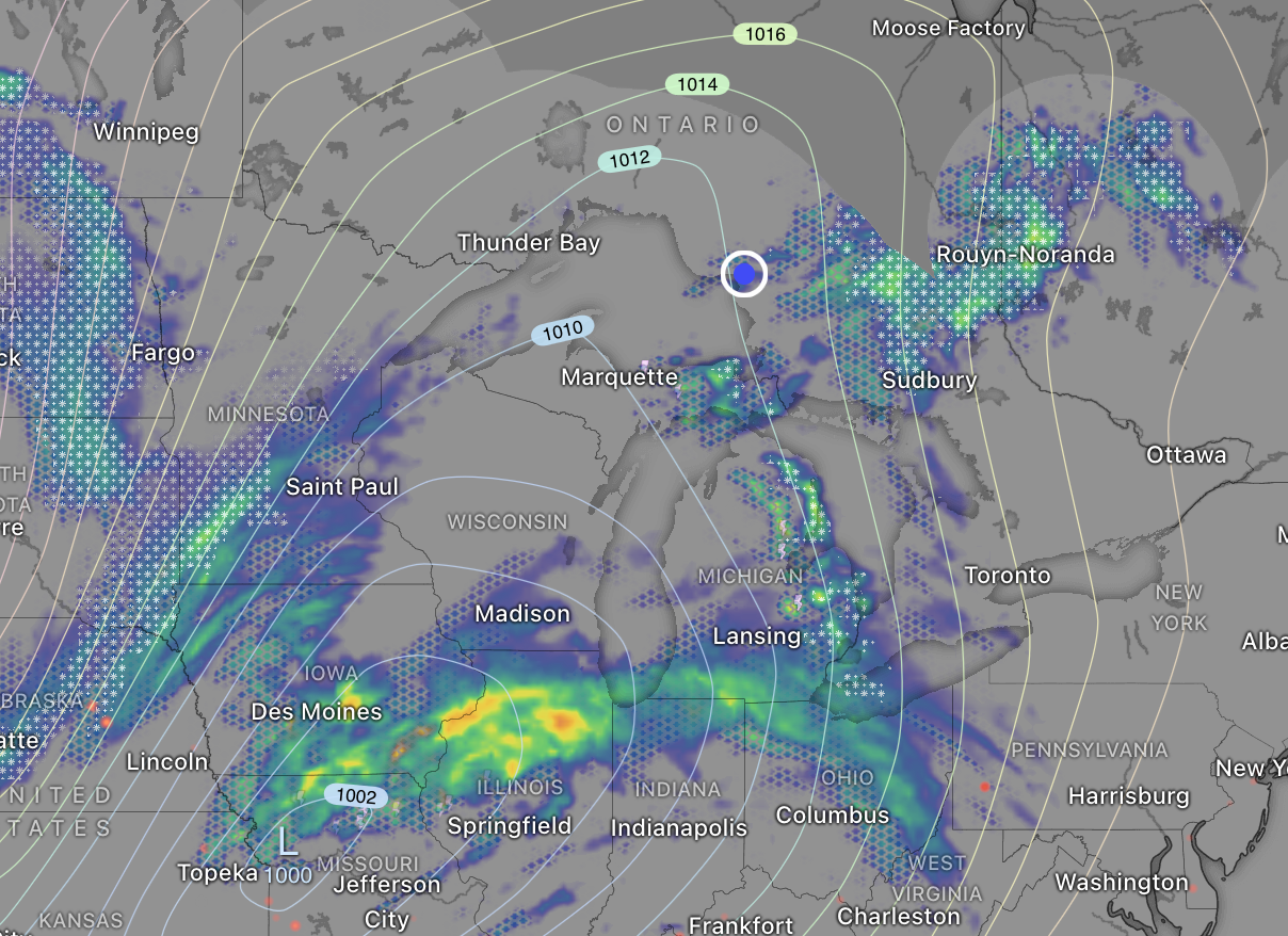
Mapping from Windy.com showing the weather radar.
Impact Level: High
Forecast Confidence: High
Hazardous winter storm expected tonight through to Monday night.
What:
- Freezing rain with 5 to 10 mm of ice accretion.
- Snowfall amounts of 20 to 40 cm.
- Northwesterly wind gusts of 60 to 80 km/h.
- Blizzard conditions.
When: Beginning this evening and continuing into Monday night.
Additional information: Precipitation is expected to begin as freezing rain, ice pellets or snow this evening and continue through the overnight hours. Precipitation is expected to transition to snow early Monday morning. The strong northwesterly winds will pick up through Monday morning leading to blizzard conditions.
Roads and walkways will likely be very difficult to navigate. Visibility will likely be suddenly reduced to near zero at times. Road closures are possible. Prolonged utility outages are likely. Significant property or tree damage is possible.
Prepare for quickly changing and deteriorating travel conditions. Avoid non-essential travel and outdoor activities.
Prepare for disruptions to transportation, services and utilities.
Dec 27, 2025 at 20:49
Impact Level: High
Forecast Confidence: High
Hazardous winter storm expected Sunday evening to Monday night.
What:
- Freezing rain with 5 to 10 mm of ice accretion.
- Snowfall amounts of 20 to 40 cm.
- Strong northwesterly winds with gusts of 60 to 80 km/h
- Blizzard conditions.
When: Beginning Sunday evening and continuing into Monday night.
Additional information: Precipitation is expected to begin as freezing rain Sunday evening and continuing through the overnight. The freezing rain is expected to transition to snow early Monday morning. During the transition a brief period of ice pellets is possible.
The strong northwesterly winds will pick up through Monday morning leading to blizzard conditions. Roads and walkways will likely be very difficult to navigate.
Visibility will likely be suddenly reduced to near zero at times. Road closures are possible.
Prolonged utility outages are likely. Significant property or tree damage is possible.
Prepare for quickly changing and deteriorating travel conditions. Avoid non-essential travel and outdoor activities. Prepare for disruptions to transportation, services and utilities.
Dec 27, 2025 at 09:08
 5:17 AM EST Saturday 27 December 2025
Impact Level: High
Forecast Confidence: High
A major winter storm expected Sunday evening to Monday evening.
What:
- Possible snowfall amounts of 20 to 40 cm.
- Visibility near zero in heavy snow and blowing snow.
- Northerly winds gusting up to 70 km/h.
When: Beginning Sunday evening through to Monday evening.
Additional information:
A rapidly intensifying low pressure system is expected to track over the Great Lakes. Precipitation is expected to begin as freezing drizzle or flurries before transitioning to snow and widespread blowing snow Sunday night. Snow may be mixed with ice pellets at times. Northerly winds gusting up to 70 km/h are expected Monday morning and afternoon.
There remains some uncertainty regarding the track of the low pressure system and as a result exact precipitation amounts remain somewhat uncertain.
Roads and walkways may be very difficult to navigate. Visibility may be suddenly reduced to near zero at times. Road closures are possible. Prolonged utility outages are possible.
Prepare for possibly prolonged disruptions to transportation, services, and utilities.
Orange Alert = Severe weather
Red Alert = Very dangerous and possibly life-threatening weather
For road conditions and other traveller information from the Ministry of Transportation, visit https://www.ontario.ca/511, or call 5-1-1.
Please continue to monitor alerts and forecasts issued by Environment Canada. To report severe weather, send an email to [email protected] or tweet reports using #ONStorm.
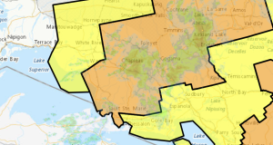
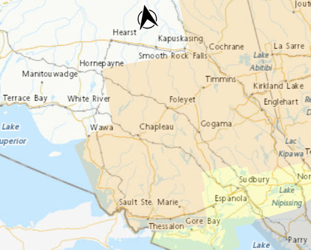
- Hazardous winter storm expected Sunday night (Wawa – Pukaskwa Park) - December 28, 2025
- Hazardous Winter Storm Expected Sunday Night (Montreal River Harbour – Searchmont) - December 28, 2025
- Hazardous Winter Storm Expected Sunday Night (Chapleau – Missinaibi Lake) - December 28, 2025