 Wawa-news.com Local and Regional News
This weather advisory has ended at 4:01 a.m. Monda, March 31st
 Mar 30, 2025 at 20:00
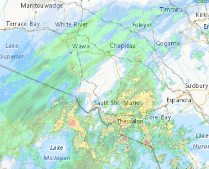
Winter Storm Warning in effect for:
- Searchmont – Montreal River Harbour – Batchawana Bay
Winter storm continues this evening through tonight.
What:
- Freezing rain with significant ice accretion of 5 to 15 mm.
- Utility outages possible.
- Slippery surfaces and broken tree branches from ice build-up.
- Snowfall and ice pellet amounts up to 20 cm north of a line from Ranger Lake to Cobalt.
When: Continuing this evening through tonight.
Snow or ice pellets has transitioned to freezing rain in most communities. Freezing rain is expected to be most significant for locations south of a line from Ranger Lake to Cobalt where ice storm conditions are possible. Precipitation will transition back to ice pellets and then snow from west to east late tonight into Monday morning.
Conditions will improve Monday morning as the weather system exits the province.
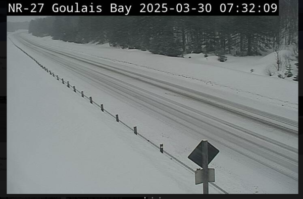
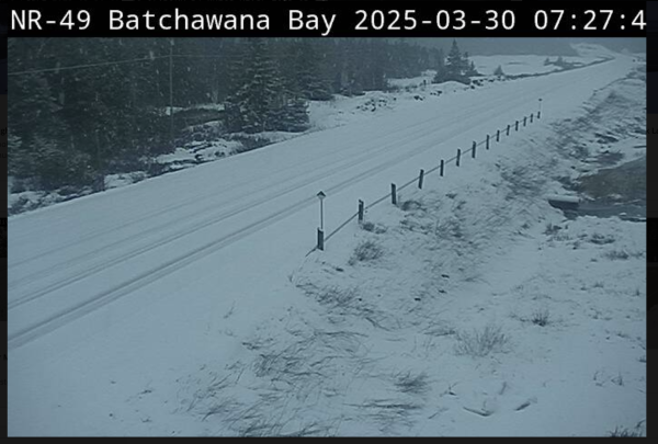
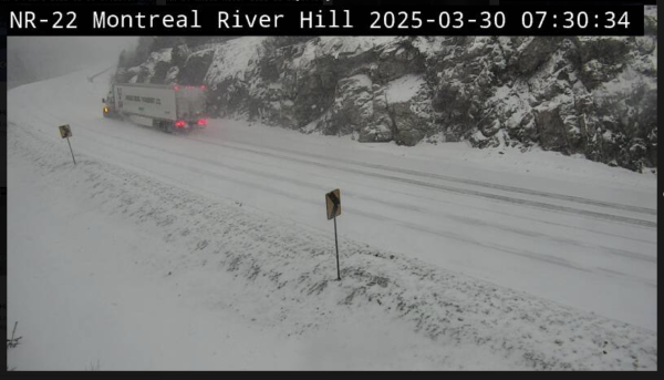
Surfaces such as highways, roads, walkways and parking lots will become icy, slippery and hazardous. Ice build-up may cause tree branches to break. Consider postponing non-essential travel until conditions improve. Prepare for quickly changing and deteriorating travel conditions.
Mar 30, 2025 at 08:00
5:29 AM EDT Sunday 30 March 2025
 |
 |
 |
Winter Storm Warning in effect for:
-
Searchmont – Montreal River Harbour – Batchawana Bay
Winter storm today into Monday morning. Ice storm likely for some.
What:
- Freezing rain with significant ice accretion of 5 to 15 mm.
- Utility outages possible.
- Slippery surfaces and broken tree branches from ice build-up.
- Snowfall and ice pellet amounts up to 15 cm north of a line from Ranger Lake to Cobalt.
When:
From this morning through Monday morning.
Several hours of snow or ice pellets are expected today before precipitation changes to freezing rain. Freezing rain is expected to be most significant for locations south of a line from Ranger Lake to Cobalt where ice storm conditions are possible. Precipitation will transition to ice pellets and then snow from west to east late tonight into Monday morning.
Conditions will improve Monday morning as the weather system exits the province.
Surfaces such as highways, roads, walkways and parking lots will become icy, slippery and hazardous. Ice build-up may cause tree branches to break.
Consider postponing non-essential travel until conditions improve. Prepare for quickly changing and deteriorating travel conditions.
Orange Alert = Severe weather
Red Alert = Very dangerous and possibly life-threatening weather
For road conditions and other traveller information from the Ministry of Transportation, visit https://www.ontario.ca/511, or call 5-1-1.
Please continue to monitor alerts and forecasts issued by Environment Canada. To report severe weather, send an email to [email protected] or tweet reports using #ONStorm.
- Snowfall Today (Wawa – Pukaskwa Park) - April 4, 2026
- Snowfall Today (Marathon – Schreiber) - April 4, 2026
- Winter Storm Today (Chapleau – Missinaibi Lake) - April 4, 2026
