Wawa-news.com Local and Regional News
May 25, 2021 at 22:12
9:40 PM EDT Tuesday 25 May 2021
Severe thunderstorm warning in effect for:
- Wawa – Pukaskwa Park
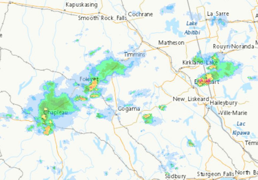
At 9:40 p.m. EDT, Environment Canada meteorologists are tracking a severe thunderstorm capable of producing very strong wind gusts.
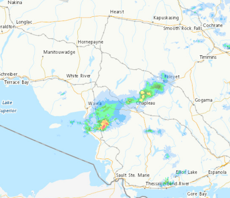
This line of severe thunderstorms is located over Lake Superior, extending southwest from Wawa and is moving east at 80 km/h.
Hazard: 90 km/h wind gusts.
Locations impacted include:
Wawa, Michipicoten Provincial Park, Lake Superior Provincial Park, Gargantua, Brient, Michipicoten, Anjigami, Tabor, Millwood and Whitefish Lake.
Strong wind gusts can toss loose objects, damage weak buildings, break branches off trees and overturn large vehicles. Hail and locally heavy rain are also possible. Avoid areas of the building that could be affected by falling debris such as tree limbs.
The Office of the Fire Marshal and Emergency Management recommends that you take cover immediately if threatening weather approaches.
Please continue to monitor alerts and forecasts issued by Environment Canada. To report severe weather, send an email to [email protected] or tweet reports using #ONStorm.
For more information: http://www.emergencymanagementontario.ca/english/beprepared/beprepared.html.
Statements
9:47 PM EDT Tuesday 25 May 2021
Fog advisory in effect for:
- Wawa – Pukaskwa Park
Areas of dense fog will continue tonight.
Areas of dense fog will persist along the Lake Superior shoreline through tonight. Fog may reduce visibility suddenly to near zero.
Fog is expected to dissipate overnight or Wednesday morning.
Travel is expected to be hazardous due to reduced visibility in some locations. If visibility is reduced while driving, turn on your lights and maintain a safe following distance.
May 25, 2021 at 21:55
9:40 PM EDT Tuesday 25 May 2021
Severe thunderstorm warning in effect for:
- Agawa – Lake Superior Park
At 9:40 p.m. EDT, Environment Canada meteorologists are tracking a severe thunderstorm capable of producing very strong wind gusts.
This line of severe thunderstorms is located over Lake Superior, extending southwest from Wawa and is moving east at 80 km/h.
Hazard: 90 km/h wind gusts.
Locations impacted include:
Wawa, Michipicoten Provincial Park, Lake Superior Provincial Park, Gargantua, Brient, Michipicoten, Anjigami, Tabor, Millwood and Whitefish Lake.
Strong wind gusts can toss loose objects, damage weak buildings, break branches off trees and overturn large vehicles. Hail and locally heavy rain are also possible. Avoid areas of the building that could be affected by falling debris such as tree limbs.
The Office of the Fire Marshal and Emergency Management recommends that you take cover immediately if threatening weather approaches.
9:22 PM EDT Tuesday 25 May 2021
Severe thunderstorm watch in effect for:
- Agawa – Lake Superior Park
Conditions are favourable for the development of severe thunderstorms that may be capable of producing strong wind gusts and large hail.
Hazards:
Up to nickel sized hail
Damaging wind gusts up to 90 km/h
Locations:
Portions of northeastern Ontario.
Timing:
This evening.
Large hail can damage property and cause injury. Strong wind gusts can toss loose objects, damage weak buildings, break branches off trees and overturn large vehicles. Be prepared for severe weather. Take cover immediately, if threatening weather approaches.
The Office of the Fire Marshal and Emergency Management recommends that you take cover immediately if threatening weather approaches.

This may be the incoming storm, thunder can be heard in the distance.
May 25, 2021 at 21:24
 9:22 PM EDT Tuesday 25 May 2021
Severe thunderstorm watch in effect for:
- Agawa – Lake Superior Park
Conditions are favourable for the development of severe thunderstorms that may be capable of producing strong wind gusts and large hail.
Hazards:
Up to nickel sized hail
Damaging wind gusts up to 90 km/h
Locations:
Portions of northeastern Ontario.
Timing:
This evening.
Large hail can damage property and cause injury. Strong wind gusts can toss loose objects, damage weak buildings, break branches off trees and overturn large vehicles. Be prepared for severe weather. Take cover immediately, if threatening weather approaches.
The Office of the Fire Marshal and Emergency Management recommends that you take cover immediately if threatening weather approaches.
 9:17 PM EDT Tuesday 25 May 2021
Severe thunderstorm warning ended for:
- Gogama – Foleyet
9:22 PM EDT Tuesday 25 May 2021
Severe thunderstorm watch in effect for:
- Chapleau – Missinaibi Lake
- Gogama – Foleyet
Persons in or near this area should be on the lookout for adverse weather conditions and take necessary safety precautions. Watch for updated statements.
May 25, 2021 at 20:12
 8:08 PM EDT Tuesday 25 May 2021
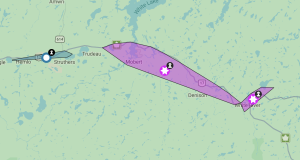
Tornado warning in effect for:
- Gogama – Foleyet
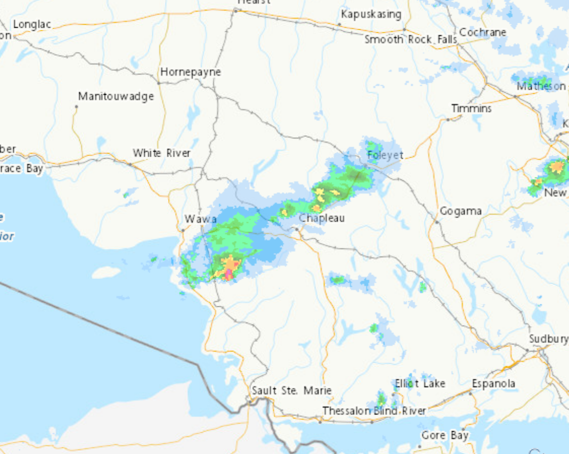
At 8:08 p.m. EDT, Environment Canada meteorologists are tracking a severe thunderstorm that is possibly producing a tornado. Damaging winds, large hail and locally intense rainfall are also possible.
This severe thunderstorm is located 15 kilometres northeast of Sultan, moving east at 70 km/h.
Hazard: Tornado and nickel size hail.
Source: RADAR indicated rotation.
Locations impacted include:
Woman River, Jerome and Rice Lake.
Another line of severe thunderstorms is located near Kenogamissi Lake, moving east at 60 km/h.
Hazard: 90 km/h wind gusts and nickel size hail.
Locations impacted include:
Kenogamissi Lake and Kapiskong Lake.
If you hear a roaring sound or see a funnel cloud, swirling debris near the ground, flying debris, or any threatening weather approaching, take shelter immediately.
Go indoors to a room on the lowest floor, away from outside walls and windows, such as a basement, bathroom, stairwell or interior closet. Leave mobile homes, vehicles, tents, trailers and other temporary or free-standing shelter, and move to a strong building if you can. As a last resort, lie in a low spot and protect your head from flying debris.
The Office of the Fire Marshal and Emergency Management recommends that you take cover immediately if threatening weather approaches.
May 25, 2021 at 20:02
8:00 PM EDT Tuesday 25 May 2021
Severe thunderstorm watch in effect for:
- Agawa – Lake Superior Park
Persons in or near this area should be on the lookout for adverse weather conditions and take necessary safety precautions. Watch for updated statements.
May 25, 2021 at 19:53
7:52 PM EDT Tuesday 25 May 2021
Tornado warning in effect for:
- Chapleau – Missinaibi Lake
- Gogama – Foleyet
Persons in or near this area should be on the lookout for adverse weather conditions and take necessary safety precautions. Watch for updated statements.
May 25, 2021 at 19:40
 7:34 PM EDT Tuesday 25 May 2021
Tornado warning in effect for:
- Chapleau – Missinaibi Lake
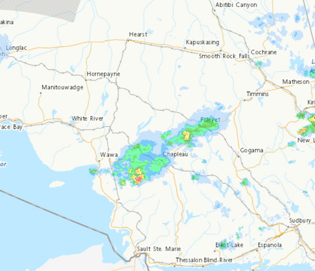
At 7:34 p.m. EDT, Environment Canada meteorologists are tracking a severe thunderstorm that is possibly producing a tornado. Damaging winds, large hail and locally intense rainfall are also possible.
This severe thunderstorm is located 20 kilometres northwest of Wakami Lake Provincial Park, moving east at 70 km/h.
Hazard: Tornado and nickel size hail.
Source: RADAR indicated rotation.
This storm will remain north of Sultan and Wakami Lake Provincial Park.
If you hear a roaring sound or see a funnel cloud, swirling debris near the ground, flying debris, or any threatening weather approaching, take shelter immediately.
Go indoors to a room on the lowest floor, away from outside walls and windows, such as a basement, bathroom, stairwell or interior closet. Leave mobile homes, vehicles, tents, trailers and other temporary or free-standing shelter, and move to a strong building if you can. As a last resort, lie in a low spot and protect your head from flying debris.
The Office of the Fire Marshal and Emergency Management recommends that you take cover immediately if threatening weather approaches.
 May 25, 2021 at 19:16
7:14 PM EDT Tuesday 25 May 2021
Tornado warning ended for:
- Chapleau – Missinaibi Lake
May 25, 2021 at 18:51
6:47 PM EDT Tuesday 25 May 2021
 Tornado warning in effect for:
- Chapleau – Missinaibi Lake
At 6:47 p.m. EDT, Environment Canada meteorologists are tracking a severe thunderstorm that is possibly producing a tornado. Damaging winds, large hail and locally intense rainfall are also possible.
A severe thunderstorm capable of producing a tornado is located near Little Antler Lake, moving east at 70 km/h.
Hazard: Tornado, golf ball size hail and 90 km/h wind gusts.
Source: RADAR indicated.
Locations impacted include:
Five Mile Lake Provincial Park and Five Mile Lake.
Take cover immediately, if threatening weather approaches.
Go indoors to a room on the lowest floor, away from outside walls and windows, such as a basement, bathroom, stairwell or interior closet. Leave mobile homes, vehicles, tents, trailers and other temporary or free-standing shelter, and move to a strong building if you can. As a last resort, lie in a low spot and protect your head from flying debris.
Tornado warnings are issued when imminent or occurring thunderstorms are likely to produce or are producing tornadoes.
The Office of the Fire Marshal and Emergency Management recommends that you take cover immediately if threatening weather approaches.
May 25, 2021 at 18:36
 6:34 PM EDT Tuesday 25 May 2021
Severe thunderstorm warning in effect for:
- Chapleau – Missinaibi Lake
Persons in or near this area should be on the lookout for adverse weather conditions and take necessary safety precautions. Watch for updated statements.
Please refer to the latest public forecasts for further details and continue to monitor the situation through your local radio and television stations or Weatheradio.
5:47 PM EDT Tuesday 25 May 2021
Severe thunderstorm watch in effect for:
- Chapleau – Missinaibi Lake
- Gogama – Foleyet
Conditions are favourable for the development of severe thunderstorms that may be capable of producing strong wind gusts and large hail.
Hazards:
Up to toonie sized hail
Damaging wind gusts up to 100 km/h
A tornado is also possible
Locations:
Portions of northeastern Ontario.
Timing:
Late this afternoon through early this evening.
Large hail can damage property and cause injury. Strong wind gusts can toss loose objects, damage weak buildings, break branches off trees and overturn large vehicles. Be prepared for severe weather. Take cover immediately, if threatening weather approaches.
The Office of the Fire Marshal and Emergency Management recommends that you take cover immediately if threatening weather approaches.
May 25, 2021 at 18:31
 6:26 PM EDT Tuesday 25 May 2021
Severe thunderstorm warning in effect for:
- Chapleau – Missinaibi Lake
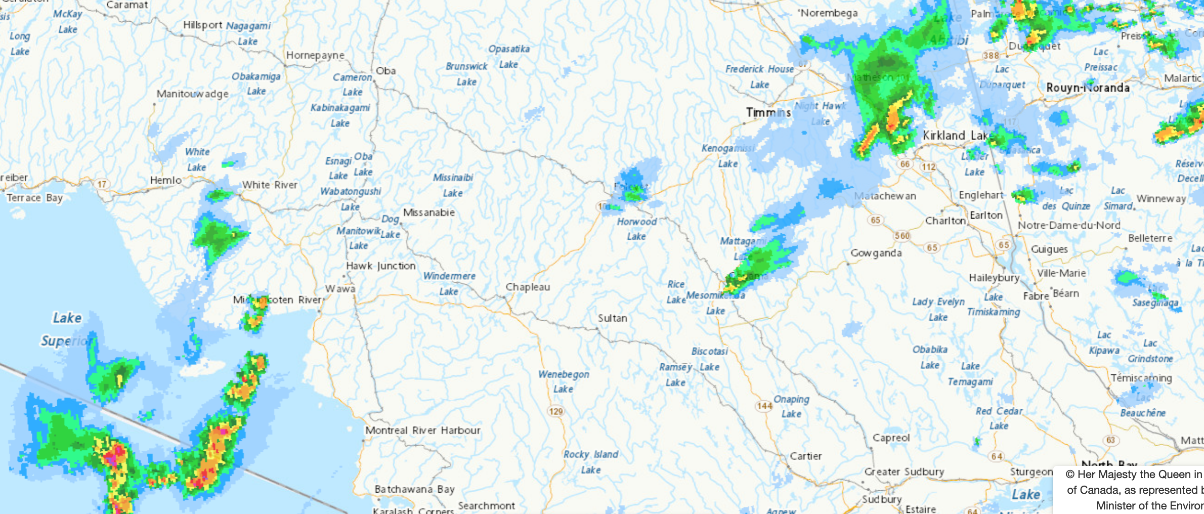
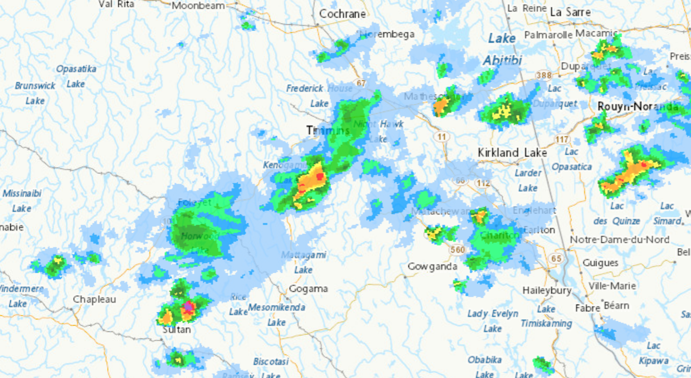
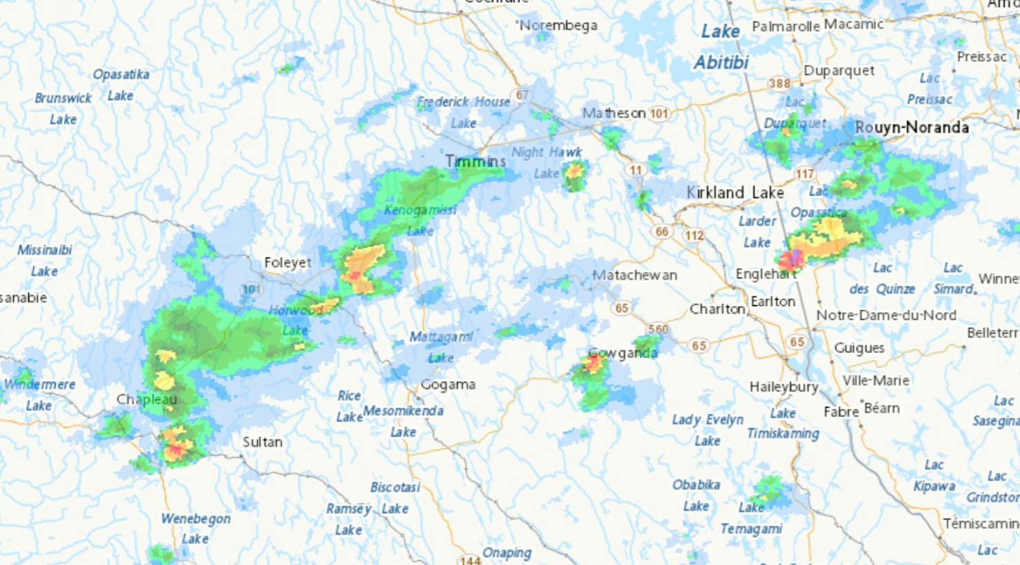
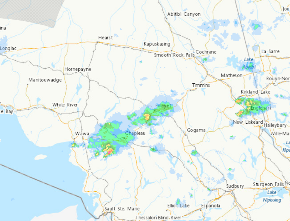
At 6:26 p.m. EDT, Environment Canada meteorologists are tracking a severe thunderstorm capable of producing very strong wind gusts and up to nickel size hail.
This severe thunderstorm is located 16 kilometres west of Graveyard Lake, moving east at 65 km/h.
Hazard: 90 km/h wind gusts and golf ball sized hail. A tornado is also possible.
Source: RADAR indicated.
Locations impacted include:
Graveyard Lake, Camptwo Lake, Antler Lake, Little Antler Lake, Gale Lake, Kawabesonka Lake, Ethier Lake, Hood Lake, Top Lake and Island Lake.
Strong wind gusts can toss loose objects, damage weak buildings, break branches off trees and overturn large vehicles.
The Office of the Fire Marshal and Emergency Management recommends that you take cover immediately if threatening weather approaches.
May 25, 2021 at 18:06
 6:04 PM EDT Tuesday 25 May 2021
Severe thunderstorm warning in effect for:
- Agawa – Lake Superior Park
At 6:04 p.m. EDT, Environment Canada meteorologists are tracking a severe thunderstorm capable of producing very strong wind gusts and up to nickel size hail.
Take cover immediately, if threatening weather approaches. Large hail can damage property and cause injury. Strong wind gusts can toss loose objects, damage weak buildings, break branches off trees and overturn large vehicles. Lightning kills and injures Canadians every year. Remember, when thunder roars, go indoors!
Severe thunderstorm warnings are issued when imminent or occurring thunderstorms are likely to produce or are producing one or more of the following: large hail, damaging winds, torrential rainfall.
The Office of the Fire Marshal and Emergency Management recommends that you take cover immediately if threatening weather approaches.
6:05 PM EDT Tuesday 25 May 2021
Severe thunderstorm warning in effect for:
- Chapleau – Missinaibi Lake
At 6:05 p.m. EDT, Environment Canada meteorologists are tracking a severe thunderstorm capable of producing very strong wind gusts and up to nickel size hail.
This severe thunderstorm is located 16 kilometres west of Graveyard Lake, moving east at 65 km/h.
Hazard: 90 km/h wind gusts and nickel size hail. A tornado is also possible.
Source: RADAR indicated.
Locations impacted include:
Graveyard Lake, Camptwo Lake, Antler Lake, Little Antler Lake, Gale Lake, Kawabesonka Lake, Ethier Lake, Hood Lake, Top Lake and Island Lake.
Strong wind gusts can toss loose objects, damage weak buildings, break branches off trees and overturn large vehicles.
The Office of the Fire Marshal and Emergency Management recommends that you take cover immediately if threatening weather approaches.
Please continue to monitor alerts and forecasts issued by Environment Canada. To report severe weather, send an email to [email protected] or tweet reports using #ONStorm.
For more information: http://www.emergencymanagementontario.ca/english/beprepared/beprepared.html.
Watches
 5:47 PM EDT Tuesday 25 May 2021
Severe thunderstorm watch in effect for:
- Chapleau – Missinaibi Lake
- Gogama – Foleyet
Conditions are favourable for the development of severe thunderstorms that may be capable of producing strong wind gusts and large hail.
Hazards:
Up to toonie sized hail
Damaging wind gusts up to 100 km/h
A tornado is also possible
Locations:
Portions of northeastern Ontario.
Timing:
Late this afternoon through early this evening.
Large hail can damage property and cause injury. Strong wind gusts can toss loose objects, damage weak buildings, break branches off trees and overturn large vehicles. Be prepared for severe weather. Take cover immediately, if threatening weather approaches.
The Office of the Fire Marshal and Emergency Management recommends that you take cover immediately if threatening weather approaches.
Please continue to monitor alerts and forecasts issued by Environment Canada. To report severe weather, send an email to [email protected] or tweet reports using #ONStorm.
May 25, 2021 at 17:59
5:47 PM EDT Tuesday 25 May 2021
 Severe thunderstorm watch in effect for:
- Agawa – Lake Superior Park
Conditions are favourable for the development of severe thunderstorms that may be capable of producing strong wind gusts and large hail.
Hazards:
Up to toonie sized hail
Damaging wind gusts up to 100 km/h
A tornado is also possible
Locations:
Portions of northeastern Ontario.
Timing:
Late this afternoon through early this evening.
Large hail can damage property and cause injury. Strong wind gusts can toss loose objects, damage weak buildings, break branches off trees and overturn large vehicles. Be prepared for severe weather. Take cover immediately, if threatening weather approaches.
The Office of the Fire Marshal and Emergency Management recommends that you take cover immediately if threatening weather approaches.
Severe thunderstorm watch in effect for:
- Chapleau – Missinaibi Lake
- Gogama – Foleyet
Conditions are favourable for the development of severe thunderstorms that may be capable of producing strong wind gusts and large hail.
Hazards:
Up to toonie sized hail
Damaging wind gusts up to 100 km/h
A tornado is also possible
Locations:
Portions of northeastern Ontario.
Timing:
Late this afternoon through early this evening.
Large hail can damage property and cause injury. Strong wind gusts can toss loose objects, damage weak buildings, break branches off trees and overturn large vehicles. Be prepared for severe weather. Take cover immediately, if threatening weather approaches.
The Office of the Fire Marshal and Emergency Management recommends that you take cover immediately if threatening weather approaches.

- Today at LSPP – Wednesday, July 29th - July 29, 2026
- Northwest Forest Fire Update – July 28 - July 29, 2026
- Northeast Forest Fire Update – July 28 - July 29, 2026