Wawa-news.com Local and Regional News
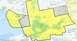
Weather – Cloudy with snow or rain beginning this morning with 2-4 cm locally, 15 cm over western sections. High of 3C.
EC continues to warn with a special weather statement in effect for:
- Wawa – Pukaskwa Park
- White River – Dubreuilville
Local snowfall amounts near 15 cm today for areas northeast of Lake Superior. Snow is expected to develop this morning and persist for much of the day. Local snowfall accumulations may approach 15 cm by this evening.
For Wawa, temperatures are expected to rise above the freezing mark today. As a result, snowfall accumulations are likely to be less than areas farther west as the snow will likely change to rain.
Roads –
| 17 | Sault Saint Marie North Limits to Montreal River Bridge | bare and wet road with bare and dry road sections. | 2017-02-28 5:25 |
| 17 | Montreal River Bridge to Wawa | bare and wet road with partly snow packed sections. | 2017-02-28 3:34 |
| 17 | Wawa to Paint Lake Rd | bare and wet road with partly snow packed sections. | 2017-02-28 3:34 |
| 17 | Paint Lake Rd to Southwest of White River | bare and wet road | 2017-02-28 5:27 |
Local – Time to get ready for the Wawa Ice Fishing Derby – Crews were out checking the lakes on February 25th – “they say a few inches of snow on top of perfect ice ….no slush!! Manitowik has 14-18″ of ice in derby boundaries and both Wawa and Hawk lake have more.”
You may wish to keep an eye on the sky this evening not only is there a conjunction of the crescent Moon and Venus; Spaceweather.com states that, “A canyon-shaped hole in the sun’s atmosphere is spewing a stream of solar wind toward Earth. Polar geomagnetic storms could begin as early as Feb. 28th when the leading edge of the stream reaches our planet. NOAA forecasters estimate a 60% chance of G1-class storms on March 1st when Earth is fully enveloped by the fast-moving solar wind.”

- Friday Morning News – July 31st - July 31, 2026
- Thursday Morning News – July 30th - July 30, 2026
- Power Outage in White River, Mobert and Hemlo – RESTORED - July 29, 2026