Wawa-news.com Local and Regional News
Dec 13, 2025 at 07:16
Dec 13, 2025 at 07:16
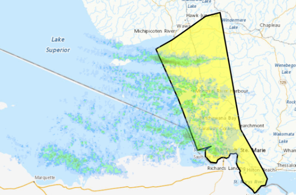
Yellow Warning – Snow Squall
5:32 AM EST Saturday 13 December 2025
Impact Level: Moderate
Forecast Confidence: High
Lake effect snow squalls continuing into this afternoon.
What: Total snowfall amounts of 15 to 30 cm. Significantly reduced visibility in heavy snow.
When: Continuing into this afternoon.
Additional information: Lake effect snow squalls will likely move south of Agawa Bay later this afternoon.
Highway 17 closures are in effect from Wawa to Batchawana Bay. Travel will likely be hazardous.
Roads and walkways will likely be difficult to navigate due to accumulating snow.
Prepare for quickly changing and deteriorating travel conditions. Prepare for possible disruptions to transportation, services, and utilities.
Dec 12, 2025 at 17:00
4:27 PM EST Friday 12 December 2025
For regions in yellow to the right
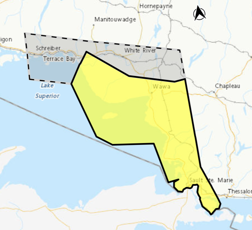 Impact Level: Moderate
Forecast Confidence: High
Lake effect snow squall continuing into tonight.
What: Snowfall amounts of 15 to 20 cm. Low visibility in areas of heavy snow.
When: Continuing into tonight.
Additional information: A weather system will bring snow to a large portion of northern Ontario. Embedded lake effect snow in the southwest winds ahead of this weather system will lead to enhanced snowfall totals for areas near Lake Superior.
As the weather system passes to the east tonight, winds will become more northwesterly, shifting the lake effect snow to areas south of Wawa.
Travel along portions of Highway 17 could be hazardous at times. Prepare for quickly changing and deteriorating travel conditions. Travel will likely be hazardous. Roads and walkways will likely be difficult to navigate due to accumulating snow. Road closures are possible.
Prepare for quickly changing and deteriorating travel conditions.
Orange Alert = Severe weather
Red Alert = Very dangerous and possibly life-threatening weather
For road conditions and other traveller information from the Ministry of Transportation, visit https://www.ontario.ca/511, or call 5-1-1.
Please continue to monitor alerts and forecasts issued by Environment Canada. To report severe weather, send an email to [email protected] or tweet reports using #ONStorm.
- Snow Squalls Truth or dare?ay (Gogama – Foleyet) - February 27, 2026
- Snow Squalls Today (Agawa – Lake Superior Park) - February 27, 2026
- Snow Squalls Today (Wawa – Pukaskwa Park) - February 27, 2026