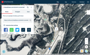
meadows.constraint.covered
What in the world does that mean?
A group of developers has created an app and three-word phrases have been used to define every 3 meter square in the world.
For example, “meadows.constraint.covered” defines the three-metre square for the Wawa Goose Monument. Or perhaps you are in the blueberry patch, your friends are bringing the picnic basket, and you don’t know how to tell them where you are – or how to get there. One or maybe both of you are map reading impaired. So with a combination of three word phrases…
- affliction, composts.margin (that takes you to the Loonskin Lake Road at the end of Wawa Lake.
- warped.function.sitting (the intersection of the Sir James Dunn Pit rail bed and the gate to Loonskin Lake
- lipstick.photographer.grilled (the Sir James Dunn Pit Rail bed and the spur along the Magpie River and on to Hawk)
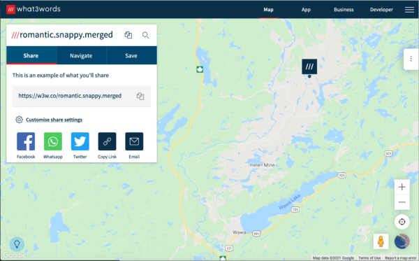
- and then, finally romantic.snappy.merged is where I’m sitting picking blueberries, don’t forget the iced tea…
They can find you.
Or you can use the app to define the secret hole along the Old Woman River where you landed that beautiful rainbow last winter…
Best yet, should you get lost, stranded, turned around, and can get a call out – you can dial 911 and the dispatcher will be able to use that 3 word phrase, determine your location, and dispatch someone to your location. I cannot tell you how many times I’ve heard officers talking to each other, “Were you able to hear them yelling”, or radioing into dispatch to ask the lost person – can they hear the horns? Or trying in the middle of a crisis to explain – go to the end of Wawa Lake, turn left onto the dirt road, go ahh, I don’t know… 5-6 kilometers and I think you turn right, or was it left? …and then your cell phone dies.
One call, three words – and they know where you are. Now you can get warm, keep that fire going, do first aid… until your knights in shining armor arrive.
It’s only a guess, but if that individual that went snowmobiling on the waters of Manitowik, had the app and his phone in a waterproof/resistant case – he may not have had to spend the night in a cold cottage, worrying family, friends in Hawk and those who were searching for him.
Most recently in the Soo, three hikers became lost while hiking in the Connor Road area. Dispatchers got them to download the what3words app, and officers and Sault Search and Rescue were able to pinpoint their location. “Anything we can deploy to locate someone in distress is a positive,” says Chief Hugh Stevenson “we are happy to be the latest Police Service to partner with what3words, and I’m proud of our dispatchers as they reacted swiftly to coordinate the use of the app to locate people in need of support.”
“Our app is free for individual users to download and use,” says what3words representative Gregoire de Chavanas, “In emergency situations, like when hikers become stranded, we believe our technology can save lives. It is fantastic to see services like the Sault Ste. Marie Police Service embrace the use of what3words and we encourage everyone to download the free app to be prepared to give their 3 words in an emergency if needed”.
For more information about the technology please visit www.what3words.com/about-us/
App developers state “It is recommended that the user download the app prior to heading out, as it works offline without a data connection and therefore there will be no limitations to being able to discover 3 words. For those who do not have the app in advance, emergency dispatchers can send a link for the app to phones via text message.”
- Thursday Morning News – February 19 - February 19, 2026
- Wednesday Morning News – February 18 - February 18, 2026
- Bus Cancellations – Batchawana Eastwards - February 18, 2026
 Wawa-news.com Local and Regional News


