 Wawa-news.com Local and Regional News
2:29 PM EDT Tuesday 07 May 2019
Special weather statement in effect for:
- Elliot Lake – Ranger Lake
- Greater Sudbury and vicinity
- Manitoulin – Blind River – Killarney
- North Bay – West Nipissing
- Sault Ste. Marie – Superior East
-
- Sault Ste. Marie – St. Joseph Island
- Searchmont – Montreal River Harbour – Batchawana Bay
Significant rainfall expected Wednesday night through Thursday.
A developing low pressure system will track over Northeastern Ontario on Thursday. Rain ahead of this system is expected to develop Wednesday night and continue Thursday before tapering to scattered showers Friday.
Total rainfall amounts of 20 to 40 mm are possible with the heaviest rain falling Thursday during the day.
The ground, already near saturation, has little ability to absorb further rainfall. Localized flooding in low-lying areas is possible.
For information concerning flooding, please consult your local conservation authority or Ontario Ministry of Natural Resources and Forestry District Office.

This is a media release by the organization. If you would like to send Wawa-news.com a media release to be published, send it to Brenda Stockton, Editor/Publisher, [email protected]
Latest posts by This Media Release (see all)
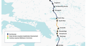
- Northlander Passenger Rail Service Returns December 10 - November 20, 2026
- Northern Ontario First Nations Release Twenty Years of Their Own Evidence on Chronic Conditions - November 19, 2026
- CAPT to host a public town hall meeting tonight about possible ski Train - November 19, 2026