 Wawa-news.com Local and Regional News
Apr 13, 2018 @ 09:20
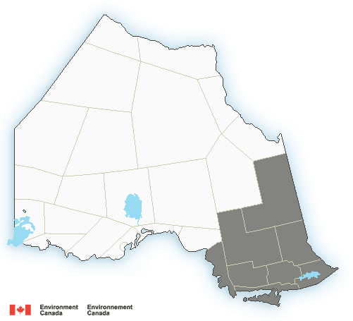
Storm expected for the following regions: Chapleau – Gogama, Elliot Lake – Ranger Lake, Greater Sudbury and vicinity, Kirkland Lake – New Liskeard – Temagami, Manitoulin – Blind River – Killarney, North Bay – West Nipissing, Sault Ste. Marie – Superior East, and Timmins – Cochrane.
Environment Canada has issued a special weather statement regarding a potential winter storm expected Sunday into Monday.
“Snow at times heavy will spread into Northeastern Ontario Sunday morning. Significant snowfall amounts of 15 to 25 cm are possible by Monday night. In addition, strong northeasterly winds will produce areas of blowing snow, leading to reduced visibilities.
Southeastern areas including Sudbury and North Bay can expect the snow to become mixed with ice pellets and possibly freezing rain on Sunday night. This may lead to reduced snowfall accumulations.
Snow and blowing snow will ease Monday night into Tuesday.”

- Tuesday Morning News – April 7 - April 7, 2026
- Hwy 17 (Wawa to Batchawana/Hwy 563) OPEN 2:25 - April 7, 2026
- Monday Morning News – April 8 - April 6, 2026
