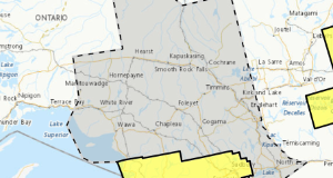
There were six new wildland fires confirmed in the Northeast Region by the evening of October 6:
- Haliburton 36 (HAL036) is 0.5 hectares and is located just east of Irvine Lake, approximately 5.8 kilometres west of Highway 400, and 1 kilometre north of Go Home Lake. The fire is being held.
- Haliburton 37 (HAL037) is 1.4 hectares and is located 0.25 kilomteres southwest of Way Lake, and approximately 1 kilometre north of Harvey Lake. The fire is not under control.
- Haliburton 38 (HAL038) is 0.2 hectares and is located approximately 3.7 kilomoetres southeast of Dividing Lake, and 1.2 kilometres northwest of Cross Corner Lake. The fire is not under control.
- Haliburton 39 (HAL039) is 3.1 hectares and is located approximately 0.5 kilometres north of Highway 19, and 2 kilometres east of Highway 13. Air Attack was conducted on this fire this afternoon. We ask that the public stay clear of the area to allow ample of room for emergency response vehicles and staff to conduct operations safely. The fire is not under control.
- North Bay 38 (NOR038) is 0.5 hectares and is located on a peninsula on the west side of Breeches Lake, approximately 0.8 kilometres south of Anima Nipissing Lake, and 0.9 kilometres east of Mannajigama Lake. The fire is not under control.
- North Bay 39 (NOR039) is 0.9 hectares and is located on the southside of Fraser Island on Lake Nipissing. The fire is not under control.
At the time of this update there are 15 active wildland fires in the Northeast Region. Seven of these fires are not under control, 3 are being held and 5 are under control.
Areas east and south of Kirkland Lake and Espanola are experiencing mainly a high to extreme fire hazard. Areas north and west of the previously mentioned locations, have a low to high hazard.
Latest posts by Natural Resources Forestry (see all)
- Northeast Forest Fire Region Update – November 1 - November 1, 2025
- Northeast Forest Fire Region Update – October 31 - October 31, 2025
- Northeast Forest Fire Region Update – October 30 - October 30, 2025
 Wawa-news.com Local and Regional News
