Wawa-news.com Local and Regional News
Severe thunderstorm watch in effect for:
- Sault Ste. Marie – St. Joseph Island (ended 15:34)
- Searchmont – Montreal River Harbour – Batchawana Bay (ended 15:34)
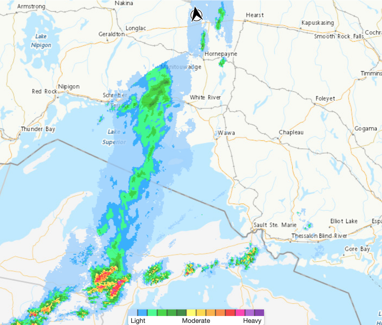 Conditions are favourable for the development of dangerous thunderstorms that may be capable of producing damaging wind gusts and large hail.
Hazards:
Wind gusts of 100 km/h.
Up to ping pong ball size hail.
Risk of a tornado.
Timing:
Mid afternoon into this evening.
Discussion:
Thunderstorms have developed over Michigan and are tracking towards the area. These thunderstorms are expected to strengthen as they approach. Thunderstorms are expected to move east of the area during the evening hours.
Large hail can damage property and cause injury. Very strong wind gusts can damage buildings, down trees and blow large vehicles off the road. Locally heavy rain is also possible. Remember, severe thunderstorms can produce tornadoes. Lightning kills and injures Canadians every year. Remember, when thunder roars, go indoors!
Severe thunderstorm watches are issued when atmospheric conditions are favourable for the development of thunderstorms that could produce one or more of the following: large hail, damaging winds, torrential rainfall.
The Office of the Fire Marshal and Emergency Management recommends that you take cover immediately if threatening weather approaches.

- First Nation Leaders to Hold Press Conference to Address Ontario’s Wildfire Response - July 21, 2026
- Northwestern Ontario Community Support Fund Established - July 21, 2026
- Men’s Night Golf – Results of July 16th - July 21, 2026