Weather, Closures, Forest Fires

Netmizaaggamig Nishnaabeg (Pic Mobert FN) – Fire Ban
July 14, 2026 By order of the Netmizaaggamig Nishnaabeg Chief and Council, effective immediately, no outdoor burning is allowed. The region’s Forest Fire Danger Ratingis high. There is one active forest fire East of Netmizaaggamig, WAW014, near Depew River. At the time of this memo, its size is 12.5ha, and the status report is being held. With the lack of ...

Read More »

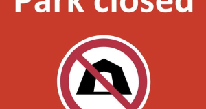
Wabakimi Provincial Park – CLOSED until July 20th

Due to the extreme forest fire conditions in and around Wabakimi Provincial Park and the evacuation orders for our surrounding communities, we are closing the entire park until July 20th, 2026. We will continue to assess the situation as it develops. Please stay safe!

Read More »

Northeast Forest Fire Update – July 14

Jul 14, 2026 at 21:54 Updated: July 14, 2026 at 7:15 p.m. Eastern Daylight Time (EDT) Three wildland fires were confirmed last night after the update was posted: Timmins 19 (TIM019) is 0.8 hectares in size and is being held. This fire is located east of East Shining Tree Lake. Timmins 20 (TIM020) was 0.1 hectares in size and is out. This ...

Read More »

Northwest Forest Fire Update – July 14

Jul 14, 2026 at 21:42 Northwest Region Updated: July 13, 2026 at 9:40 p.m.  Central Daylight Time – (Editor’s Note: I’m sure that this is meant to reflect an update date of the 14th) A total of 31 new wildland fires were discovered in the Northwest Region by the evening of July 13. Fort Frances Sector Fort Frances 38 (FOR038) is located ...

Read More »

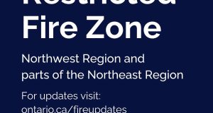
FRZ in place at 00:01 for Most of NW ON & Part of NE ON tonight, July 14th

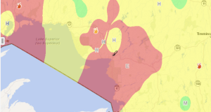
Due to the high to extreme fire hazard, increased wildland fire activity, the current fire load and to reduce the number of human-caused wildland fires, the Ministry of Natural Resources will be implementing a Restricted Fire Zone (RFZ) effective July 15 at 12:01 a.m. local time for the Northwest Region and a small portion of the Northeast Region. The areas impacted ...

Read More »

White River FD – No fire risk to Community at this time

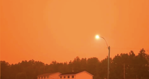
Jul 14, 2026 at 21:00 20:35: Please note that the smoke in the air causing the dark orange skies is smoke from west of here. Fires by Armstrong and further. We are still perfectly safe here in White River. Please use caution when travelling, as there is reduced visibility and wildlife is also affected by the smoke. Please check on the ...

Read More »

Marathon is currently within a Restricted Fire Zone

The Town of Marathon is currently within a Restricted Fire Zone. No fire permits will be issued or sold until the Restricted Fire Zone has been lifted. This means no open-air burning requiring a permit is permitted during this time. This includes: 🔥 Campfires and recreational fires 🔥 Outdoor fire pits and fireplaces 🔥 Chimineas 🔥 Burning grass, leaves, brush, ...

Read More »

City of Thunder Bay – Wildfire Update

12:32: A number of active wildfires throughout the region have resulted in evacuation orders and alerts for several communities. Residents from Armstrong, Whitesand First Nation, and Collins First Nation are currently seeking shelter in Thunder Bay. In addition, residents of Upsala, Lac des Mille Lacs First Nation, and the surrounding area are currently evacuating, while those in the area of ...

Read More »

Northeast Forest Fire Update – July 13

Northeast Region Updated: July 13, 2026 at 7:00 p.m. Eastern Daylight Time (EDT) No new wildland fires were confirmed in the Northeast Region today. Two wildland fires were confirmed last night after the update was issued: Wawa 15 (WAW015) is 0.7 hectares in size and is not under control. This fire is located on the eastern shore of Lake Superior in Lake ...

Read More »

Northwest Forest Fire Update – July 13

Northwest Region Updated: July 13, 2026 at 9:40 p.m.  Central Daylight Time (CDT) A total of 31 new wildland fires were discovered in the Northwest Region by the evening of July 13. Fort Frances Sector Fort Frances 38 (FOR038) is located north of Hwy. 11 near Duck Lake, approximately 26 kilometres east of Atikokan. The 5.0 hectare fire received air attack July 13 and is not under control. ...

Read More »

Forest Fire Update – July 12

Northeast Region Updated: July 12, 2026 at 7:00 p.m. Eastern Daylight Time (EDT) There was 4 new wildland fires confirmed in the Northeast Region today: Cochrane 37 (COC037) is 0.1 of a hectare and is located approximately 10 kilometres southeast of Wade Lake, and 20 kilometres east of Pyne Road. The fire is now out. Wawa 14 (WAW014) is 3 hectares and ...

Read More »

Forest Fire Update – July 11

Northeast Region Updated: July 11, 2026 at 6:00 p.m. Eastern Daylight Time (EDT) There was 1 new wildland fire confirmed in the Northeast Region today: Wawa 13 (WAW013) is 0.4 of a hectare and is located approximately 1 kilometre southwest of Crocker’s Lake, and 0.75 of a kilometre northwest of Little Owl Lake. The fire is not under control. There ...

Read More »

Hwy 11/17 (East of Thunder Bay) Open

Jul 11, 2026 at 19:24 CLEARED (6:00 p.m.): Highway 11-17 all lanes have reopened near Highway 527 following a collision. ^pia ~ SITUATION NORMALE (18 h) : Toutes les voies de l’autoroute 11-17 ont été rouvertes à la circulation près de l’autoroute 527 à la suite d’un accident. Jul 11, 2026 at 16:24 UPDATE (4:13 p.m.): Highway 11-17 has reopened ...

Read More »