Wawa-news.com Local and Regional News
May 22, 2021 at 22:00
Thunderstorm watch ended:
- City of Thunder Bay (20:59)
- Superior West (20:59)
Thunderstorm Warning ended:
- Cloud Bay – Dorion (20:59)
- Kakabeka Falls – Whitefish Lake – Arrow Lake (20:59)
- Atikokan – Shebandowan – Quetico Park (20:13)
May 22, 2021 at 19:18
7:11 PM EDT Saturday 22 May 2021
Severe thunderstorm warning in effect for:
- Cloud Bay – Dorion
- Kakabeka Falls – Whitefish Lake – Arrow Lake
- Atikokan – Shebandowan – Quetico Park
At 6:11 p.m. EST (7:11 p.m. EDT), Environment Canada meteorologists are tracking a severe thunderstorm capable of producing strong wind gusts, up to toonie size hail and heavy rain.
At 23:11 UTC, Environment Canada meteorologists are tracking a few severe thunderstorms capable of producing strong wind gusts, up to quarter size hail and heavy rain.
Large hail can damage property and cause injury. Strong wind gusts can toss loose objects, damage weak buildings, break branches off trees and overturn large vehicles. Lightning kills and injures Canadians every year. Remember, when thunder roars, go indoors!
Severe thunderstorm warnings are issued when imminent or occurring thunderstorms are likely to produce or are producing one or more of the following: large hail, damaging winds, torrential rainfall.
The Office of the Fire Marshal and Emergency Management recommends that you take cover immediately if threatening weather approaches.
6:51 PM EDT Saturday 22 May 2021
Severe thunderstorm warning in effect for:
- Kirkland Lake – Englehart
This severe thunderstorm is located 25 kilometres northwest of Kirkland Lake, moving southeast at 30 km/h.
Hazard: 90 km/h wind gusts and quarter size hail.
Locations impacted include: Kirkland Lake.
Take cover immediately, if threatening weather approaches. Strong wind gusts can toss loose objects, damage weak buildings, break branches off trees and overturn large vehicles. Intense lightning is likely with any thunderstorm that develops. Lightning kills and injures Canadians every year. Remember, when thunder roars, go indoors!
Severe thunderstorm warnings are issued when imminent or occurring thunderstorms are likely to produce or are producing one or more of the following: large hail, damaging winds, torrential rainfall.
The Office of the Fire Marshal and Emergency Management recommends that you take cover immediately if threatening weather approaches.
May 22, 2021 at 12:01
at 11:25 Environment Canada posted:
Severe thunderstorm watch in effect for:
- City of Thunder Bay
- Cloud Bay – Dorion
- Kakabeka Falls – Whitefish Lake – Arrow Lake
- Fort Frances – Emo – Rainy River
- Seine River Village – Mine Centre
- Ignace – English River
- Atikokan – Shebandowan – Quetico Park
- Upsala – Raith
Conditions are favorable for the development of severe thunderstorms this afternoon. The main threats are wind gusts up to 90 km/h, quarter size hail, and heavy rain with local amounts of 30 mm.
Lightning kills and injures Canadians every year. Remember, when thunder roars, go indoors!
Severe thunderstorm watches are issued when atmospheric conditions are favourable for the development of thunderstorms that could produce one or more of the following: large hail, damaging winds, torrential rainfall.
The Office of the Fire Marshal and Emergency Management recommends that you take cover immediately if threatening weather approaches.
May 22, 2021 at 10:37
 Instant Weather Northern Ontario is reporting that they “are seeing an enhanced risk for severe thunderstorms today in parts of northwestern Ontario and this risk will extend towards isolated parts of northeastern Ontario into the evening. A large region around Thunder Bay looks to have an enhanced risk for large hail, damaging wind gusts, intense lightning, isolated flooding, and perhaps even isolated tornadoes. Northeastern Ontario looks like more of a marginal risk but we’ll be watching it closely this evening. Please have a plan in place and stay safe, folks!”

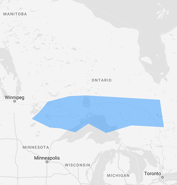
Looking at thunderstorm projections from “Windy”, a system is moving east from Winnipeg and may create a number of thunderstorms over Thunder Bay as it heads east. Wawa may be just on the edge of this system. In Marathon it is 10C, foggy and 100% humidity, and in Wawa and White River it is 14C, foggy and 100% humidity.

- Tuesday Morning News – July 21st - July 21, 2026
- Monday Morning News – July 20th - July 20, 2026
- Wawa FD called to Backyard Bonfire during RFZ - July 19, 2026