Wawa-news.com Local and Regional News
Jan 7, 2019 @ 07:06
 Weather – Snow at times heavy and local blowing snow. Amount 15 to 25 cm. Wind becoming southeast 30 km/h gusting to 60 except gusting to 90 near Lake Superior. High minus 1. Wind chill minus 18 in the morning and minus 8 in the afternoon.
Tonight – Snow and local blowing snow ending late this evening then mainly cloudy. Amount 2 to 4 cm. Wind southeast 30 km/h gusting to 50 becoming light this evening. Temperature steady near zero. Wind chill minus 9 in the evening.
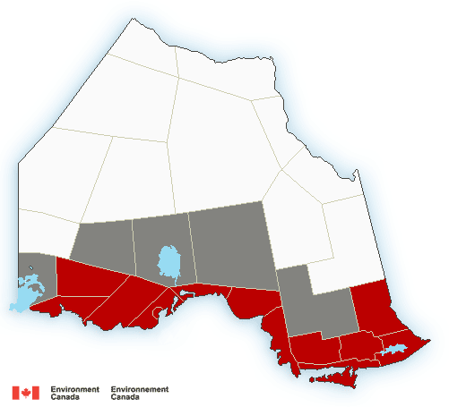
As of 5:18 AM Environment Canada continued the winter storm warning in effect for:
- Wawa – Pukaskwa Park
- White River – Dubreuilville
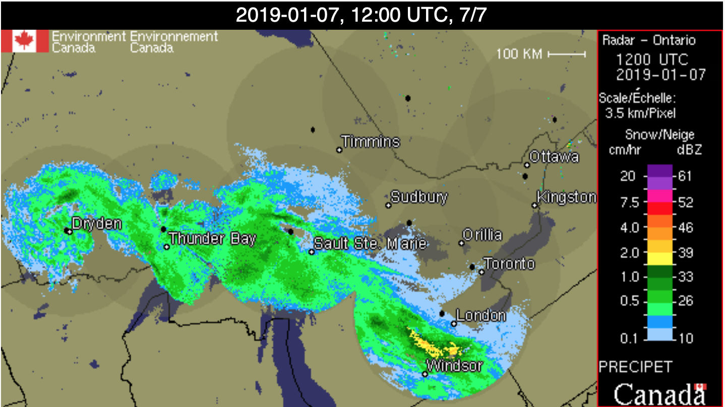
Winter storm today.
Snow heavy at times along with frequent blowing snow is expected today as a strong low pressure system moves across Lake Superior. Total snowfall amounts of 15 to 25 cm are likely by this evening.
Strong southeast winds gusting up to 70 km/h will whip up the freshly fallen snow resulting in blowing snow in many areas. Stronger southeast wind gusts to 90 km/h are also expected along the Lake Superior shoreline. The winter storm will come to an end tonight as the low pressure system moves away to the east of the region.
Consider postponing non-essential travel until conditions improve. Rapidly accumulating snow could make travel difficult over some locations. Visibility will be suddenly reduced to near zero at times in heavy snow and blowing snow.
Please note that this winter storm warning continues for most of Northern Ontario.
News Tidbits – residents along a portion of Toronto Avenue, Wawa Street and Ontario Street will want to be aware of a power outage Tuesday, January 8, 2018 (Alternate date: Wednesday January 9, 2018), between the hours of 9:00am and 12:00pm for a new pole and conductor installation.

- Tuesday Morning News – July 28th - July 28, 2026
- Monday Morning News – July 27 - July 27, 2026
- Saturday Morning New – July 25th - July 25, 2026