Wawa-news.com Local and Regional News
WINTER STORM WARNING FOR NORTHERN ONTARIO
ISSUED BY ENVIRONMENT CANADA
AT 5:00 A.M. EST WEDNESDAY 26 DECEMBER 2018.
———————————————————————
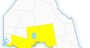
 WINTER STORM WARNING – REPLACES WINTER STORM WATCH FOR:
 CITY OF THUNDER BAY
ATIKOKAN – UPSALA – QUETICO
SUPERIOR WEST
GULL BAY – BLACK STURGEON LAKE
BEARDMORE – JELLICOE – MACDIARMID
GERALDTON – LONGLAC – CARAMAT
MANITOUWADGE – HORNEPAYNE
NIPIGON – MARATHON – SUPERIOR NORTH
WAWA – WHITE RIVER – PUKASKWA.
———————————————————————
==DISCUSSION==
A significant winter Storm is expected Thursday night into Friday night.
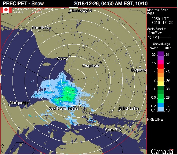
A Colorado low tracking towards the Great Lakes and northeastward across the regions will give heavy snow and blowing snow. Regions from Sault Ste. Marie to North Bay may also experience a period of freezing rain or rain Thursday night and through Friday before a cold front sweeps eastward across the regions giving more snow and blowing snow.
Travel may be impacted or become hazardous due to this storm moving across the regions from Thursday afternoon into early Saturday morning.
Cold wind chill values are also expected with the passage of the cold front on Friday or Friday night.
Winter storm watches may be issued for this event and this statement will be updated as new information becomes available.

This is a media release by the organization. If you would like to send Wawa-news.com a media release to be published, send it to Brenda Stockton, Editor/Publisher, [email protected]
Latest posts by This Media Release (see all)
- KZA Evacuation Update (July 21 at 7 a.m. - July 21, 2026
- First Nation Leaders to Hold Press Conference to Address Ontario’s Wildfire Response - July 21, 2026
- Northwestern Ontario Community Support Fund Established - July 21, 2026