Wawa-news.com Local and Regional News
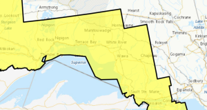
Mar 6, 2026 at 08:42 8:43 AM EST Friday 6 March 2026 No alerts in effect. Mar 5, 2026 at 18:45 Yellow Advisory – Freezing Drizzle 6:26 PM EST Thursday 5 March 2026 Impact Level: Moderate Forecast Confidence: High Areas of freezing drizzle are expected. What: Freezing drizzle resulting in icy and slippery conditions. When: Beginning overnight or early Friday ...
Read More »Freezing Drizzle Expected Tonight (Manitouwadge – Hornepayne) ENDED