Wawa-news.com Local and Regional News
Jun 21, 2025 at 15:53
At 3:51 0.m. this Watch ended.
Jun 21, 2025 at 15:07
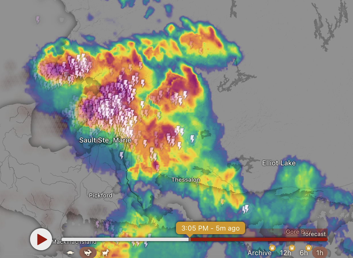
Weather Map from Windy.com
Severe Thunderstorm Warning in effect for:
- Searchmont – Montreal River Harbour – Batchawana Bay
At 3:02 PM EDT, Environment Canada meteorologists are tracking a severe thunderstorm capable of producing nickel to ping pong ball size hail and heavy rain.
Take immediate cover if a thunderstorm approaches. If outside, protect yourself from flying debris and hail.
Emergency Management Ontario recommends that you take cover immediately if threatening weather approaches. Severe thunderstorm warnings are issued when imminent or occurring thunderstorms are expected to produce damaging hail, wind or rain.
This watch has ended.
Jun 21, 2025 at 08:26
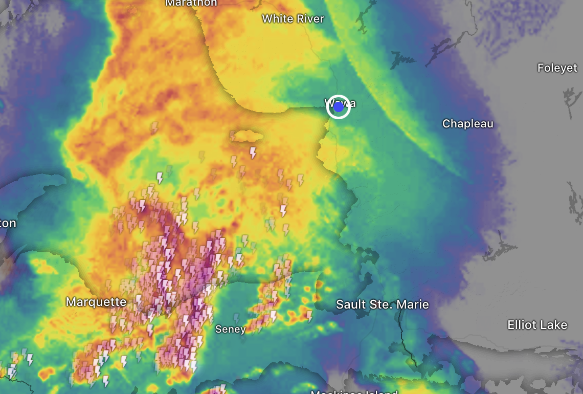
Map from Windy.com, Weather Radar imagery from 8:25 a.m.
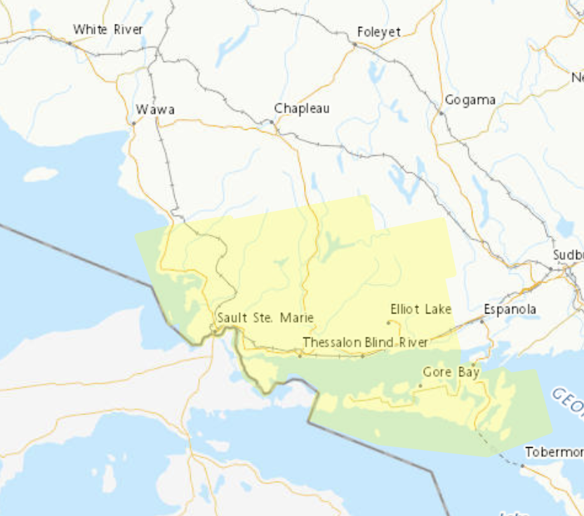 Severe Thunderstorm Watch in effect for:
- Searchmont – Montreal River Harbour – Batchawana Bay,
- and areas in yellow show on map to right
Conditions are favourable for the development of severe thunderstorms.
Hazards: Wind gusts to 90 km/h possible. Heavy rainfall.
When: Later this morning. Additional information: A line of strong thunderstorms is pushing across Lake Superior and is expected to impact the region later this morning. This line is expected clear near midday with the potential for more thunderstorm development this afternoon.
Local utility outages are possible. Damage to roofs, fences, branches or soft shelters is possible.
When thunder roars, go indoors! Lightning kills and injures Canadians every year. Emergency Management Ontario recommends that you take cover immediately if threatening weather approaches.
Severe thunderstorm watches are issued when conditions are favourable for the development of thunderstorms capable of producing damaging hail, wind or rain.
Please continue to monitor alerts and forecasts issued by Environment Canada. To report severe weather, send an email to [email protected] or post reports on X using #ONStorm.
Orange Alert = Severe weather
Red Alert = Very dangerous and possibly life-threatening weather
For road conditions and other traveller information from the Ministry of Transportation, visit https://www.ontario.ca/511, or call 5-1-1.
Please continue to monitor alerts and forecasts issued by Environment Canada. To report severe weather, send an email to [email protected] or tweet reports using #ONStorm.
- Snowfall Today (Wawa – Pukaskwa Park) - April 4, 2026
- Snowfall Today (Marathon – Schreiber) - April 4, 2026
- Winter Storm Today (Chapleau – Missinaibi Lake) - April 4, 2026