Wawa-news.com Local and Regional News
Jan 26, 2019 @ 21:01
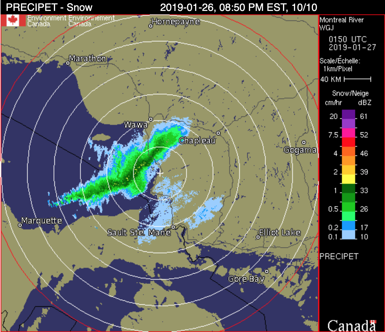 Snow squall warning in effect for:
- Wawa – Pukaskwa Park
- White River – Dubreuilville
- Agawa – Lake Superior Park
Snow squalls are expected to continue this evening.
Lake effect snow squalls east of Lake Superior are expected to slowly start moving south this evening. Total snowfall accumulations of 15 to 25 cm are possible with the highest amounts falling in areas close to Wawa.
These squalls are expected to move south of the area later this evening.
Snow squalls cause weather conditions to vary considerably; changes from clear skies to heavy snow within just a few kilometres are common. Travel is expected to be hazardous due to reduced visibility in some locations. Consider postponing non-essential travel until conditions improve.
Extreme Cold Warning in effect for:
- Wawa – Pukaskwa Park
- White River – Dubreuilville
A multi-day episode of very cold wind chills continues.
Extreme wind chills of minus 40 to minus 50 are expected across much of Northern Ontario again tonight.
This arctic air mass will remain entrenched over the region through the weekend and into early next week, bringing a prolonged period of extremely cold wind chills.
Extreme cold puts everyone at risk.
Dress warmly. Dress in layers that you can remove if you get too warm. The outer layer should be wind resistant.
If it’s too cold for you to stay outside, it’s too cold for your pet to stay outside.

- Premier Doug Ford visits Thunder Bay - July 18, 2026
- Assistance & Support for Wildfire Evacuees - July 18, 2026
- Evacuation Information (Thunder Bay) - July 18, 2026