Wawa-news.com Local and Regional News
11:14 AM EST Sunday 03 February 2019
Special weather statement in effect for:
- Wawa – Pukaskwa Park
- White River – Dubreuilville
Significant snowfall Monday into Monday night.
Snow will spread over Northeastern Ontario early Monday. Total snowfall amounts of 15 to 20 cm are possible by the time the snow ends Tuesday morning.
Hazardous winter driving conditions from accumulating snow and low visibility in snow are anticipated.
This snow is the result of a strong low pressure system from Colorado that will track over Northeastern Ontario Monday night.
11:17 AM EST Sunday 03 February 2019
Special weather statement in effect for:
- Sault Ste. Marie – St. Joseph Island
- Searchmont – Montreal River Harbour – Batchawana Bay
Freezing rain and snow Monday into Monday night.
Snow or freezing rain will spread over Northeastern Ontario early Monday and persist into Monday night. Freezing rain may be mixed with ice pellets or snow.
Precipitation is expected to transition to rain or snow Monday night before coming to an end Tuesday morning.
Hazardous winter driving conditions from accumulating snow and icy surfaces due to freezing rain are anticipated.
The snow and freezing rain are the result of a strong low pressure system from Colorado that will track over Northeastern Ontario.
Please continue to monitor alerts and forecasts issued by Environment Canada. To report severe weather, send an email to [email protected] or tweet reports using #ONStorm.
11:14 AM EST Sunday 03 February 2019
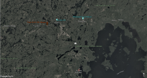
Special weather statement in effect for:
- Agawa – Lake Superior Park
Significant snowfall Monday into Monday night.
Snow will spread over Northeastern Ontario early Monday. Total snowfall amounts of 15 to 20 cm are possible by the time the snow ends Tuesday morning.
Hazardous winter driving conditions from accumulating snow and low visibility in snow are anticipated.
This snow is the result of a strong low pressure system from Colorado that will track over Northeastern Ontario Monday night.
Please continue to monitor alerts and forecasts issued by Environment Canada. To report severe weather, send an email to [email protected] or tweet reports using #ONStorm.
11:07 AM EST Sunday 03 February 2019
Freezing drizzle advisory in effect for:
- Agawa – Lake Superior Park
- Sault Ste. Marie – St. Joseph Island
- Searchmont – Montreal River Harbour – Batchawana Bay
Patchy freezing drizzle continues.
Freezing drizzle is expected to continue today into this evening.
Surfaces such as highways, roads, walkways and parking lots may become icy and slippery. Freezing drizzle can produce thin, hard-to-detect layers of ice. Take extra care when walking or driving in affected areas.

- Today at LSPP – Monday, July 20th - July 20, 2026
- Air Quality – Yellow Alert (July 20) - July 20, 2026
- Evacuation Order – Thunder Bay 36, 54 & 56 and Dryden 34 & 35 - July 20, 2026