Wawa-news.com Local and Regional News
Jul 6, 2017 @ 13:14
 12:55 PM EDT Thursday 06 July 2017
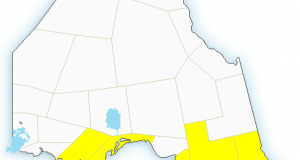
Severe thunderstorm warning in effect for:
- Sault Ste. Marie – St. Joseph Island
- Searchmont – Montreal River Harbour – Batchawana Bay
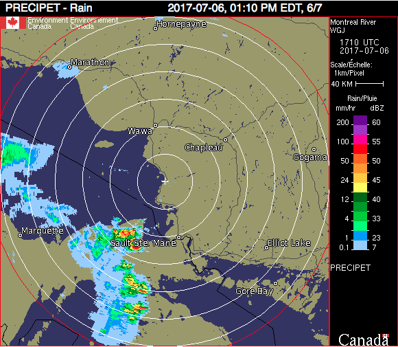
At 12:55 p.m. EDT, Environment Canada meteorologists are tracking a severe thunderstorm capable of producing very strong wind gusts, up to nickel size hail and heavy rain.
A line of severe thunderstorms is moving east at 65 km/h across Upper Michigan towards Sault Ste. Marie early this afternoon and is expected to continue east for the next few hours. Wind gusts near 90 km/h and 2 to 3 cm size hail are possible with these storms.
Take cover immediately, if threatening weather approaches. Strong wind gusts can toss loose objects, damage weak buildings, break branches off trees and overturn large vehicles. Remember, severe thunderstorms can produce tornadoes. Lightning kills and injures Canadians every year. Remember, when thunder roars, go indoors!
Severe thunderstorm warnings are issued when imminent or occurring thunderstorms are likely to produce or are producing one or more of the following: large hail, damaging winds, torrential rainfall.
The Office of the Fire Marshal and Emergency Management recommends that you take cover immediately if threatening weather approaches.
Please continue to monitor alerts and forecasts issued by Environment Canada. To report severe weather, send an email to [email protected] or tweet reports using #ONStorm.

- Premier Doug Ford visits Thunder Bay - July 18, 2026
- Assistance & Support for Wildfire Evacuees - July 18, 2026
- Evacuation Information (Thunder Bay) - July 18, 2026