Wawa-news.com Local and Regional News
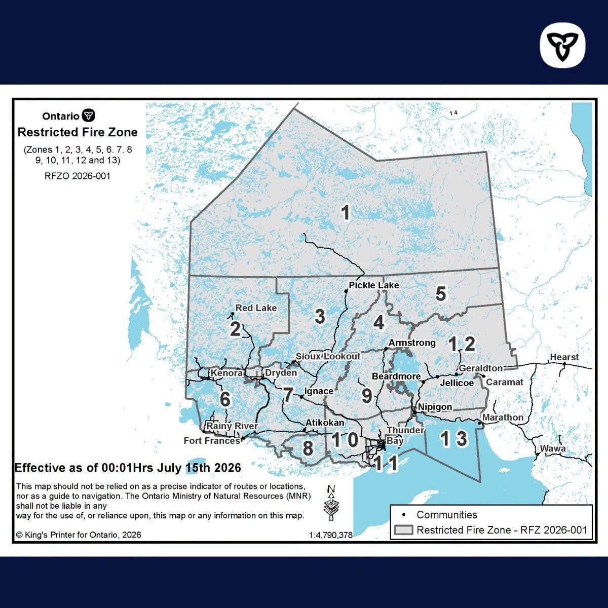
Due to the high to extreme fire hazard, increased wildland fire activity, the current fire load and to reduce the number of human-caused wildland fires, the Ministry of Natural Resources will be implementing a Restricted Fire Zone (RFZ) effective July 15 at 12:01 a.m. local time for the Northwest Region and a small portion of the Northeast Region.
The areas impacted are from the corner of the borders of the USA, Manitoba and Ontario , north along the Manitoba and Ontario border to a point southwest of the Echoing River, then southeast in a straight line to roughly 40 kilometres northeast of the community of Kitchenuhmaykoosib, then east to a point roughly 73 kilometres northwest of the community of Attawapiskat, then south to roughly 12 kilometres south of Highway 11, then west to the northeast tip of Sandlink Lakes, then south following Sandlink Creek to Northeast Bay on McKay Lake, following the eastern shore of McKay Lake to the entrance of the Pic River, then south along the Pic River to Lake Superior Canada/US border in Lake Superior. This order is required to reduce the number of human-caused wildland fires. We are expecting the current fire hazard to remain, along with the potential for problematic fires to continue and expect a continuation of the increased forest fire activity into the foreseeable future.
No open air burning, including campfires, is permitted within the boundaries of a Restricted Fire Zone. Portable gas or propane stoves may be used for cooking and warmth but must be handled with extreme caution. All burning permits are suspended. The Restricted Fire Zone will be in place until further notice.
If your municipality has also imposed a fire ban, you must comply with both the restricted fire zone (RFZ) and municipal fire ban.
- Wawa Community Outreach Program to Suspend Services Due to Unrenewed Funding - October 20, 2026
- NW Forest Fire Region Update – October 19 - October 20, 2026
- NE Forest Fire Region Update – October 19 - October 20, 2026