Wawa-news.com Local and Regional News
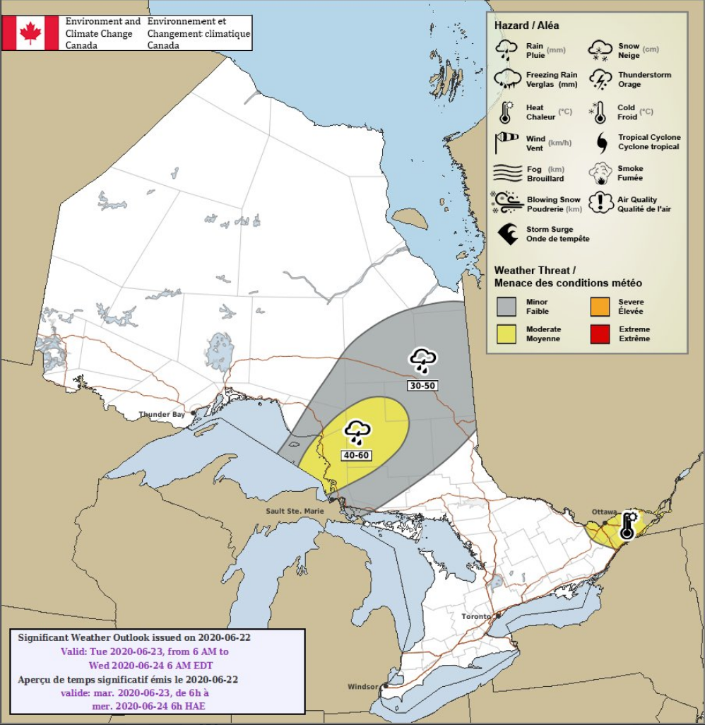
click for larger image
Rainfall warning in effect for Lake Superior Park to Batchawana Bay. Environment Canada states that “Persons in or near this area should be on the lookout for adverse weather conditions and take necessary safety precautions.” Wawa is just on the edge of the expected heavy rain.
at 5:20 this morning Environment Canada issued a special weather statement regarding significant rainfall. That warning can be read here.
Other areas affected are:
Rainfall warning in effect for:
- Chapleau – Missinaibi Lake
Rain, at times heavy, is expected.
Significant rainfall likely tonight through Tuesday.
Rain, at times heavy, will begin tonight and continue through Tuesday. General rainfall totals of 40 to 60 mm are expected by Wednesday morning, although local amounts exceeding 75 mm are possible. Rain may linger Wednesday and into Thursday giving additional, although lesser amounts.
Heavy downpours can cause flash floods and water pooling on roads. If visibility is reduced while driving, slow down, watch for tail lights ahead and be prepared to stop. Watch for possible washouts near rivers, creeks and culverts.
Rainfall warnings are issued when significant rainfall is expected.
Special weather statement in effect for:
- Timmins – Cochrane – Iroquois Falls
Significant rainfall possible over parts of northeastern Ontario tonight through Tuesday night.
Rain is expected to begin today over areas to the east of Lake Superior and spread to the east and northeast tonight. General rainfall amounts of 30 to 40 mm are likely in a swath from north of Sault Ste. Marie to Timmins. Localized higher amounts could reach 60 mm by Wednesday morning.
This rainfall is associated with a slow moving low pressure system approaching from the US Midwest.
Environment Canada continues to monitor the situation. Rainfall warnings may be issued as necessary. Rainfall warnings are issued when 50 mm in 24 hours is expected.

- Tuesday Morning News – July 21st - July 21, 2026
- Monday Morning News – July 20th - July 20, 2026
- Wawa FD called to Backyard Bonfire during RFZ - July 19, 2026