Wawa-news.com Local and Regional News
Northeast Fire Region
- By the evening of August 1, there were 49 active forest fires across the northeast. Of these, 21 are not yet under control, 28 are either being held, under control or being observed.
- There were ten new fires confirmed in the region today, one of which has already been called out. All of the new fires confirmed today that remain active are located in the Cochrane sector, more specifically in the Far North. These nine active fires are Cochrane 25, 26, 27, 28, 29, 30, 31, 32 and 33. They are all located southwest of the community of Fort Severn.
Incident Management Teams
- Incident Management Teams (IMTs) are in place in the region. They are managing priority fires in the following areas:
- Lady Evelyn Cluster
- Parry Sound 33
- Pembroke Cluster
Lady Evelyn Fire Cluster
- This fire was confirmed on July 8, 2018.
- It is not yet under control and measures 27,285 hectares.
- Values protection equipment remains in place for camps and cottages located on Mendelssohn Lake and Skull Lake.
- There is over 12km of dozer guard along the northwest head of the fire.
- There are over 200 front line forest fire fighters assigned to this fire.
Parry Sound 33
- Parry Sound 33 has been remapped at 11,039 hectares in size. Recent weather allowed more accurate aerial mapping of the fire and aerial ignition in the southeast added to the increased size.
- Fire behaviour was less active today as high humidity levels and cloud cover aided in fire suppression.
- Winds were generally out of the east today and changed the fire’s direction of spread to the west. Hose lines on the west side of the fire held the fire’s spread in check.
- Excellent progress was made on the eastern side of the fire as crews were able to establish lines due to reduced fire behaviour when compared to previous days. Crews are laying hose from the Pickerel River south to establish a perimeter on areas that have passed over the CN line.
- Structural protection continues along the Key and French Rivers.
- Crews continue to work the perimeter of the fire by the north and northwest of Key Harbour. Sixty firefighters remain along the east side, south of the Key River to continue perimeter containment. Aerial ignition occurred in the southeast part of the fire removing hazardous fuels and tying the fire into the northern shore of Henvey Inlet.
- Even though the focus of aerial fire suppression is on the northeast side, we continue to supress and monitor all portions of the fire. The fire remained quiet in the vicinity of Fox Island on the western perimeter.
- North and east winds today made for smoky conditions in communities to the south. Winds are forecasted to be out of the south tomorrow, moving to the southwest in the afternoon. The fire is approximately five kilometres west of highway 69 and less than one kilometre south of Pickerel River near the CN trestle bridge on the west side of highway 69.
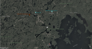
- Earlier this week, the Municipality of Killarney issued an evacuation order for residents in the areas of Travers, Allen, Struthers, Kilpatrick, Bigwood (including Hartley Bay Road), a portion of Mowat, the Unsurveyed Area, 14 Mile Island and French River Provincial Park. For information, call the municipality at 705-287-2424.
- Earlier this week, the Municipality of French River issued an Evacuation Alert for the Alban area, west of the high powered hydro lines on Highway 64. For more information, call the municipality at 705-898-2294 or visit www.frenchriver.ca
- For updates on highway conditions, including closures, please call 511.
- For information about the fire situation: 1-888-220-7242
- For media inquiries: 705-564-6156
- For inquiries about French River Provincial Park restrictions: 705-857-1630 ext. 224
- For inquiries about Grundy Lake Provincial Park closure: 705-383-2286 or 705-795-0803
- For Parry Sound District information, including calls related travel restrictions or to the recommendation of these evacuations and alerts, call 705-773-4218.
- For Sudbury District information, including calls related to travel restrictions or to the recommendation of evacuation alerts, call 705-564-7963.
(Aerial view of Parry Sound 33 this week, provided by Matt Bell, Information Officer)
(Aerial view of Parry Sound 33 this week, provided by Matt Bell, Information Officer)
(Early morning briefing for a group of FireRangers on July 31)
Pembroke Fire Cluster
- Crews continue to make good progress on all fires. Pembroke 5 and Pembroke 7 are under control. Pembroke 6 and Algonquin Park 11 are being held.
Resources From Out of Province
- Ontario is receiving support from across Canada, the United States and Mexico to assist with the fire situation. A total of 533 firefighters and support staff are currently in the province.
- Alberta is providing personnel, equipment and aircraft.
- British Columbia is providing personnel and equipment.
- Newfoundland is providing personnel and equipment.
- Northwest Territories is providing personnel, equipment and aircraft.
- Nova Scotia is providing personnel and equipment.
- Prince Edward Island is providing personnel.
- New Brunswick is providing personnel.
- Saskatchewan is providing personnel.
- Minnesota, USA, is providing personnel.
- Wisconsin, USA, is providing personnel.
- Mexico is providing personnel.
- Parks Canada is providing two ignition specialists.
- Two T215 waterbombers from Quebec landed in Ontario today to help assist with the forest fire situation.
- Additional personnel and equipment are expected to arrive in the province in the coming days.
Smoke concerns
- A wind shift pushed smoke from active forest fires increasingly towards the south this afternoon. Smoke was reported along Hwy 559.
- Smoke from large fires across the region will be visible until fire activity is reduced and weather patterns change.
- AFFES is reminding the public that if they do see flames or smoke, please report it, and stay away from the area in the interest of public safety.
- If you have questions or concerns about smoke and your health, please contact Tele Health Ontario at 1-866-797-0000.
RESTRICTED FIRE ZONES
Restricted fire zone expanded to additional parts of the Northeast fire region (southern region)
Due to the extreme fire hazard, several recent periods of heavy lightning, little precipitation and increased forest fire activity, the Ministry of Natural Resources and Forestry has expanded the Restricted Fire Zone to include parts of the Southern Region of Ontario as outlined on the interactive map. This expansion of the current Restricted Fire Zone will be in effect as of 12:01 AM on July 24, and will remain in place until further notice.
- The expanded Restricted Fire Zone now includes Zones 24, 25, & 26 which would include areas south of the French River, including Parry Sound, from Georgian Bay east to the Quebec border, including Algonquin Provincial Park and from Renfrew north to Mattawa.
- To date, the current MNRF Restricted Fire Zone covers Zones 16, 17, 18, 19, 20, 21, 24, 25, & 26 and restrictions will remain in place until further notice. See the fire map for an outline of the zones covered.
- During a Restricted Fire Zone, the use of open fires – such as campfires, or burning of brush or debris is restricted. Failure to comply could result in fines of up to $25,000 and three months in jail, as well as financial responsibility for the costs incurred in fighting a forest fire.
- Portable gas or propane stoves are permitted for use for cooking or warmth, though they should be closely monitored. Portable charcoal BBQs and Hibachis are not permitted unless within 100 metres of a dwelling, or within an organized campground.
- Commercial campground operators may allow their guests to enjoy campfires during a Restricted Fire Zone period provided they meet certain conditions in the Outdoor Fires Regulation (207/96).
The Restricted Fire Zone is a temporary measure to reduce the number of new human-caused wildfires as the Aviation Forest Fire and Emergency Services branch of the OMNRF expects the elevated forest fire hazard to continue into the foreseeable future.
Fire numbers and online information
- To report a forest fire located south of the French or Mattawa rivers, please dial 911.
- Follow us on Twitter: @ONForestFires / @ONFeudeforêt
Fire hazard in the northwest region
The fire hazard in the region is currently high in the Kenora and western portion of the Fort Frances District. Conditions in the Dryden, Red Lake and Sioux lookout Districts range from moderate to low. Thunder Bay and Nipigon Districts are currently under a low fire hazard.
New fire starts for Aug. 1
- Sioux Lookout 103
- Near the Bow River, approximately 190 kilometres northeast of Sioux Lookout
- 0.1 hectares
- Not under control
Emergency area order for Kenora fire 71
The Ministry of Natural Resources and Forestry is advising the public of an Emergency Area Order for the area around Kenora Fire 71 to ensure public safety. As a result the order restricts travel on Werner Lake Road. as well as Crown land use and travel within the boundaries of the Emergency Area Order.
Fire numbers and online information
- To report a forest fire located north of the French and Mattawa rivers, please dial 310-FIRE
- Follow us on Twitter: @ONForestFires / @ONFeudeforêt
- Northeast Forest Fire Region Update – November 1 - November 1, 2025
- Northeast Forest Fire Region Update – October 31 - October 31, 2025
- Northeast Forest Fire Region Update – October 30 - October 30, 2025