 Wawa-news.com Local and Regional News
Dec 16, 2025 at 23:09

Orange Regions: Winter storm expected with snowfall amounts of 30 to 50 cm. Beginning Wednesday night and ending from west to east through the day Friday.
Impact Level: Moderate
Forecast Confidence: High
Temperatures are forecast to fall rapidly.
Ponding water, slush, and any falling precipitation will freeze as the temperature drops.
What: Temperatures rapidly falling below freezing leading to icy conditions.
When: Tonight. Additional information: A sharp cold front will push through the area tonight leading to a rapid drop in temperatures to below the freezing mark. Overnight lows are expected to be anywhere from -10 to -18 degrees Celsius.
Roads and walkways may quickly become icy and slippery. Icy surfaces will likely form quickly and could be difficult to detect. Be very careful if walking or driving.
Please continue to monitor alerts and forecasts issued by Environment Canada. To report severe weather, send an email to [email protected] or post reports on X using #ONStorm.
Dec 16, 2025 at 16:02
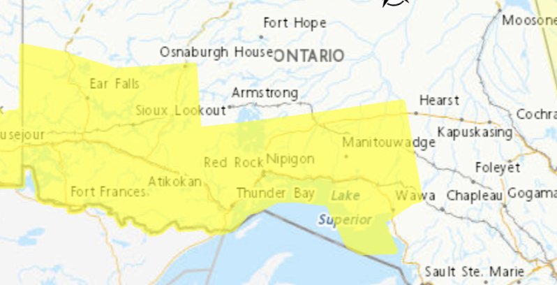
Yellow Warning – Flash Freeze
Impact Level: Moderate
Forecast Confidence: High
Temperatures are forecast to fall rapidly.
Ponding water, slush, and any falling precipitation will freeze as the temperature drops.
What: Temperatures rapidly falling below freezing leading to icy conditions.
When: This evening into tonight.
Additional information: Temperatures are expected to reach the low to mid single digits this afternoon into this evening.
A sharp cold front will push through the area this evening leading to a rapid drop in temperatures to below the freezing mark. Overnight lows are expected to be anywhere from -10 to -18 degrees Celsius.
Roads and walkways may quickly become icy and slippery. Icy surfaces will likely form quickly and could be difficult to detect. Be very careful if walking or driving.

- Thursday Morning News – June 25th - June 25, 2026
- LSPP – Gargantua Road Closed - June 24, 2026
- Wednesday Morning News – June 24 - June 24, 2026
