Wawa-news.com Local and Regional News
Updated: July 24, 2026 at 7:15 p.m. Central Daylight Time (CDT)
There were 2 new wildland fire confirmed in the Northwest Region by the evening of July 24.
- Nipigon 83 (NIP083) is located near the southwest side of Sim Lake, approximately 23 kilometres northwest of Kagianagami Lake. The 5.0-hectare fire is not under control.
- Nipigon 84 (NIP084) near the shoreline of Lake Nipigon, approximately 11.5 kilometres west of Beardmore. The 0.2-hectare fire is not under control.
At the time of this update there are 133 active wildland fires in the Northwest Region. Of those fires, 30 are not under control, 5 are being held, 6 are under control 92 are being observed.
To access the current forest fire danger rating in your area visit our interactive fire map.
Fires of note
Thunder Bay 36 (THU036)
- The fire was more accurately remapped to 315,431 hectares on July 22 through perimeter mapping flights and ground truthing efforts.
- Fire crews are continuing to locate and extinguish hot spots along the fire perimeter, with helicopter bucketing operations providing support.
- Heavy equipment operators are making good progress constructing fire guards.
- Values protection efforts are ongoing.
Atikokan Cluster – Fort Frances 14 (FOR014), Fort Frances 15 (FOR015), Fort Frances 38 (FOR038)
- FOR014 is currently measuring 51,806 hectares and remains not under control.
- FOR015 is currently measuring 42,279 hectares and remains not under control.
- Additional firefighting crews from Alberta and Ontario have been assigned to both FOR014 and FOR015.
- Crews continue to establish hose lines and patrol for fire activity, supported by bucketing helicopters.
- Infrared scanning flights have begun to help identify hotspots for crews to target.
- FOR038, north of Crystal Lake, is under control at 44.2 hectares in size.
Sioux Lookout 72 – Cat Lake First Nation
- Sioux Lookout 72 was among the fires that exhibited significant growth on July 13 and 14.
- The fire is currently measuring 23,597 hectares and is not under control.
- Fire Ranger crews are making good progress on suppression efforts supported by bucketing helicopters targeting hotspots.
- Hydro One has replaced burnt poles along the Cat Lake hydro line and power has been restored.
Brightsand Cluster – Dryden 34 (DRY034), Dryden 35 (DRY035), Thunder Bay 54 (THU054), and Thunder Bay 56 (THU056)
- There have been no significant changes to the fire perimeters in several days.
- Minimal fire behaviour was observed again today.
- DRY034 is currently measuring 44,954 hectares and remains not under control.
- DRY035 is currently measuring 22,461 hectares and remains not under control.
- FireRanger crews are working establishing hose lines alongside heavy equipment operators constructing fire guards along portions of DRY035.
- THU054 is currently measuring 7,859 hectares and remains not under control.
- THU056 is currently measuring 7,947 hectares and remains not under control.
- Bucketing helicopters are targeting hotspots while heavy equipment operators construct fire guards along portions of THU056.
Dryden 36 – Upper and Lower Moosehide Lakes
- The fire is currently measuring 1,784 hectares and is not under control.
- Ontario FireRangers are working alongside Alberta Wildfire fire fighters, bucketing helicopters and heavy equipment operators in suppression operations.
- Minimal growth has been observed in several days under favourable weather conditions.

- SSM Kidney Walk – Matching Gift Challenge - September 19, 2026
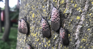
- Invasive Insect, Spotted Lanternfly, Detected in Ontario and Canada for the First Time - September 19, 2026
- Men’s Night Golf – Results of September 17th - September 19, 2026