Wawa-news.com Local and Regional News
4:42 PM EST Saturday 17 February 2018
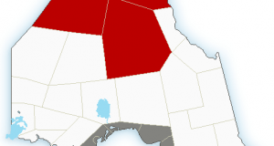
Special weather statement in effect for:
- Wawa – Pukaskwa Park
- White River – Dubreuilville
- Agawa – Lake Superior Park
- Searchmont – Montreal River Harbour – Batchawana Bay
Snowstorm on the way.
A disturbance approaching from the Northern Plains States is expected to spread an area of snow into Northeastern Ontario beginning Sunday and continuing Sunday night.
Latest indications suggest total snowfall amounts of near 15 cm are quite possible by Monday morning.
More snow is expected on Monday.
Hazardous winter driving conditions from accumulating snow on untreated roads and low visibility in areas of heavier snow are expected with this weather system. Motorists should be prepared to change travel plans accordingly.
Snowfall warnings will likely be issued later tonight or Sunday as this event draws nearer.
Please continue to monitor alerts and forecasts issued by Environment Canada. To report severe weather, send an email to [email protected] or tweet reports using #ONStorm.

- SSM Kidney Walk – Matching Gift Challenge - September 19, 2026
- Invasive Insect, Spotted Lanternfly, Detected in Ontario and Canada for the First Time - September 19, 2026
- Men’s Night Golf – Results of September 17th - September 19, 2026