Wawa-news.com Local and Regional News
Northeast Region
Updated: July 12, 2026 at 7:00 p.m. Eastern Daylight Time (EDT)
There was 4 new wildland fires confirmed in the Northeast Region today:
- Cochrane 37 (COC037) is 0.1 of a hectare and is located approximately 10 kilometres southeast of Wade Lake, and 20 kilometres east of Pyne Road. The fire is now out.
- Wawa 14 (WAW014) is 3 hectares and is located approximately 0.4 of a kilometre east of Highway 17 and 0.7 of a kilometre southwest of O’Brien Lakes. The fire is not under control.
- Chapleau 10 (CHA010) is 4 hectares and is located approximately 2 kilometres west of Airport Access Road and 1 kilometre north of Nokomis Beach road. The fire is not under control.
- Wawa 15 (WAW015) is 0.7 of a hectare and is located approximately 2 kilometres west of Highway 17, and 3 kilometres south east of Vrooman Island. The fire is not under control.
There are currently 32 active wildland fires in the Northeast Region. Of these: 4 are under control, 3 is not under control, and 25 are being observed.
Northwest Region
Updated: July 12, 2026 at 8:40 p.m. Central Daylight Time (CDT)
Twenty-nine new wildland fires were confirmed in the Northwest Region by the evening of July 12.
- Fort Frances 34 (FOR034) is located approximately 1 kilometre east of Baldwin Lake and 4.5 kilometres west of Respite Lake. The 0.5-hectare fire is not under control.
- Fort Frances 35 (FOR035) is located on an island in Gargoyle Lake, approximately 1.5 kilometres north of Pinecone Lake Road. The 0.5-hectare fire is not under control.
- Dryden 30 (DRY030) is located northwest of Lower Moosehide Lake, near Berglund Road. The 0.1-hectare fire is not under control.
- Dryden 31 (DRY031) is located approximately 10 kilometres east of Highway 502, between Washeibemaga Lake and Long Lake River. The 0.2-hectare fire is not under control.
- Red Lake 23 (RED023) is located approximately 3.0 kilometres southwest of the community of McDowell Lake First Nation. The 50.0-hectare fire is not under control.
- Nipigon 34 (NIP034) is located near the south side of Toronto Lake, approximately 14 kilometres north of Auden. The 1.0-hectare fire is not under control. CL-415 waterbombers provided aerial suppression support on the fire.
- Sioux Lookout 74 (SLK074) is located approximately 6.5 kilometres northeast of Osnaburgh Lake, near Povey Lake. The 1.0-hectare fire is not under control.
- Sioux Lookout 75 (SLK075) is located approximately 3.0 kilometres south of Rat Rapids, between Doghole Bay and Highway 599. The 0.6-hectare fire is being held.
- Sioux Lookout 76 (SLK076) was located near the shore of Lake St. Joseph, south of Doghole Bay, approximately 5 kilometres west of the Albany River South Channel. The fire was called out at 0.1 hectares.
- Sioux Lookout 77 (SLK077) is located near the north shore of Lake St. Joseph, between Twiname Bay and Searson Bay. The 0.3-hectare fire is being held.
- Sioux Lookout 78 (SLK078) is located approximately 10.5 kilometres east of Highway 599, south of Pashkokogan Lake. The 0.3-hectare fire is not under control.
- Sioux Lookout 79 (SLK079) is located approximately 11 kilometres west of Highway 599, between Doran Lake and Metcalf Lake. The 1.0-hectare fire is being held. CL-415 waterbombers provided aerial suppression support on the fire.
- Sioux Lookout 80 (SLK080) is located approximately 2.5 kilometres east of Highway 599, approximately 6 kilometres south of Rat Rapids. The 0.6-hectare fire is not under control. CL-415 waterbombers provided aerial suppression support on the fire.
- Sioux Lookout 81 (SLK081) is located approximately 11 kilometres west of Highway 599, near Miniss Lake. The 0.1-hectare fire is under control.
- Sioux Lookout 82 (SLK082) is located approximately 8.5 kilometres east of Achapi Lake. The 85.0-hectare fire is being observed.
- Sioux Lookout 83 (SLK083) is located approximately 30 kilometres northeast of Achapi Lake, near Coulas Lake. The 15.0-hectare fire is being observed.
- Thunder Bay 36 (THU036) and Thunder Bay 37 (THU037) are located in a remote area of Wabakimi Provincial Park, approximately 14 kilometres northeast of Wabakimi Lake, west of Berg River. The two fires measure 100.0 hectares each and are not under control.
- Thunder Bay 38 (THU038) and Thunder Bay 39 (THU039) are located in a remote area of Wabakimi Provincial Park, between Davies Lake and Redman Lake. The two fires measure 8.0 hectares each and are not under control.
- Thunder Bay 40 (THU040) is located in a remote area of Wabakimi Provincial Park, approximately 6 kilometres west of Scrag Lake. The 0.5-hectare fire is not under control.
- Thunder Bay 41 (THU041) and Thunder Bay 42 (THU042) are located in a remote area of Wabakimi Provincial Park, southwest of Burntrock Lake. The two fires measure 3.0 and 0.5 hectares respectively and are not under control.
- Thunder Bay 43 (THU043) was located approximately 1 kilometre west of the intersection of Penny Road and Third Road. The fire was called out at 0.1 hectares.
- Thunder Bay 44 (THU044) is located in a remote area of Wabakimi Provincial Park, approximately 4 kilometres east of Grayson Lake, northwest of Whitewater Lake. The 0.2-hectare fire is not under control.
- Thunder Bay 45 (THU045) is located in a remote area of Wabakimi Provincial Park, approximately 5 kilometres north of Grayson Lake. The 181.0-hectare fire is not under control.
- Thunder Bay 46 (THU046) is located in a remote area of Wabakimi Provincial Park, approximately 1 kilometre northwest of Sollows Lake. The 0.2-hectare fire is not under control.
- Thunder Bay 47 (THU047) is located in a remote area of Wabakimi Provincial Park, approximately 8 kilometres west of Grayson Lake. The 3.0-hectare fire is not under control.
- Thunder Bay 48 (THU048) is located approximately 7 kilometres east of Greenbush Lake, west of Rockcliff Lake. The 0.5-hectare fire is not under control.
At the time of this update there are 102 active wildland fires in the Northwest Region. Of those fires, 32 are not under control, 7 are being held, 4 are under control and 59 are being observed.
To access the current forest fire danger rating in your area visit our interactive fire map.
Fires of note
Fort Frances 14
- Fort Frances 14 (FOR014) is located approximately 35 kilometres southwest of Upsala near Byers Lake.
- The fire is now measuring 1,749.7 hectares and is not under control.
- There are 13 FireRanger crews, 10 Type-2 fire fighting crews, and 12 helicopters assigned to suppression operations
- Increased fire behaviour was observed today as hot, dry conditions persist.
- Ground crews and bucketing helicopters were supported throughout the day by CL-415 waterbombers.
- A NOTAM is now in effect over the fire area.
Fort Frances 15
- Fort Frances 15 (FOR015) is located in Quetico Provincial Park, south of Pickerel Lake.
- The fire is now measuring 1,751.9 hectares and is not under control.
- Increased fire behaviour was observed today as hot, dry conditions persist. Smoke is visible in the area.
- Quetico Provincial Park has issued a closure in parts of the park. Details can be found on their webpage.
Restrictions in effect
NOTAM – Fort Frances 14
There is currently a NOTAM in the area of wildland fire Fort Frances 14, northeast of Byers Lake.
This is over and above the standard airspace restrictions imposed by Section 601.15 of the Canadian Aviation Regulations (CARs) which state that the airspace around all active forest fires is restricted to forest fire suppression aircraft only, specifically airspace within 5 nautical miles, up to an altitude of 3000 feet above ground level.
Pilots are reminded that NOTAMs concerning forest fires can be found on NavCanada’s Collaborative Flight Planning Services under the ‘Weather and NOTAM’ tab, when flight planning.
NOTAM – Nipigon 16
There is currently a NOTAM in the area of wildland fire Nipigon 16 near Kasabonika Lake First Nation.
This is over and above the standard airspace restrictions imposed by Section 601.15 of the Canadian Aviation Regulations (CARs) which state that the airspace around all active forest fires is restricted to forest fire suppression aircraft only, specifically airspace within 5 nautical miles, up to an altitude of 3000 feet above ground level.
Pilots are reminded that NOTAMs concerning forest fires can be found on NavCanada’s Collaborative Flight Planning Services under the ‘Weather and NOTAM’ tab, when flight planning.

- SSM Kidney Walk – Matching Gift Challenge - September 19, 2026
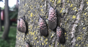
- Invasive Insect, Spotted Lanternfly, Detected in Ontario and Canada for the First Time - September 19, 2026
- Men’s Night Golf – Results of September 17th - September 19, 2026